Central Florida Experiences Mild Weather as Tropical Storm Helene Lifts North
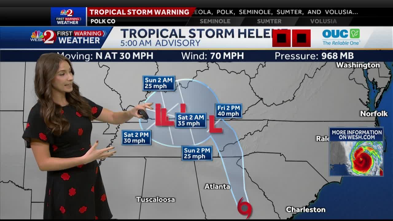
After battering areas of Florida, Hurricane Helene has now been downgraded to a tropical storm and is lifting northward into Georgia. Although the storm once reached Category 4 status, prompting widespread tornado warnings across Central Florida, the region is now seeing a significant decrease in severe weather conditions. Fortunately, much of the storm’s intensity has subsided, and Central Florida is entering a period of recovery with only mild impacts remaining.
As of Friday morning, the outer bands of Helene were still pushing through parts of Central Florida, bringing occasional showers and gusty winds. However, these showers are moving quickly and are not expected to linger, giving the area some relief. The National Weather Service has already canceled tornado watches for most parts of the region. By midday, Central Florida is expected to experience improving conditions, with the possibility of partly cloudy skies later in the afternoon.
Also Read:- Hoda Kotb Announces Departure from the TODAY Show, Sparking Emotional Farewells
- Rangers Triumph Over Malmö in a Dominant 2-0 Victory in Europa League Opener
Residents in parts of Osceola and Orange counties may still see isolated showers, and areas like Port Saint John and Titusville could experience brief pockets of heavier rainfall. Despite this, most of Central Florida will see a return to normal weather patterns, although some coastal areas remain under advisories. Flagler County, for instance, continues to be under a coastal flood warning, while a high surf advisory remains in effect until 4 p.m.
Although the most severe weather has passed, some lingering impacts of the storm can still be felt. Overnight, strong winds caused scattered power outages throughout the region. Areas like Volusia County reported around 14,000 residents without power, while Marion County saw nearly 44,000 outages. Power restoration efforts are already underway, and crews have made significant progress as winds have calmed.
The tropical air mass left behind by Helene has created warm, muggy conditions across the region. Temperatures are expected to climb into the lower 90s by afternoon, making for a hot and humid day. However, as the storm continues to weaken and move northward through Tennessee and Kentucky, Central Florida can look forward to a calmer weekend. With the severe weather threat diminishing, locals can enjoy a slightly warmer-than-usual late September weekend.
For those living in areas where the storm made landfall, the story is far from over. Helene is expected to bring heavy rainfall and the potential for flooding to parts of Georgia, Tennessee, and Kentucky over the weekend. However, for Central Florida, the worst appears to be behind us, and the region can begin the process of returning to normal.
As always, it’s essential to stay updated on any weather changes. The First Warning Weather team will continue to monitor the storm's progress and provide updates as needed. Despite some lingering showers, the outlook is positive, and Central Florida is gradually emerging from the effects of Tropical Storm Helene.
Read More:

0 Comments