

Tropical Wave Tracker: Gulf of Mexico Braces for Potential Storm
As we head into the upcoming week, the Gulf of Mexico is under close scrutiny due to an evolving tropical situation. The National Hurricane Center (NHC) has its eyes on a trio of tropical waves that are making their way through the Atlantic and into the Gulf. This includes a notable system currently designated as Invest 91L, which has sparked significant attention due to its potential development.
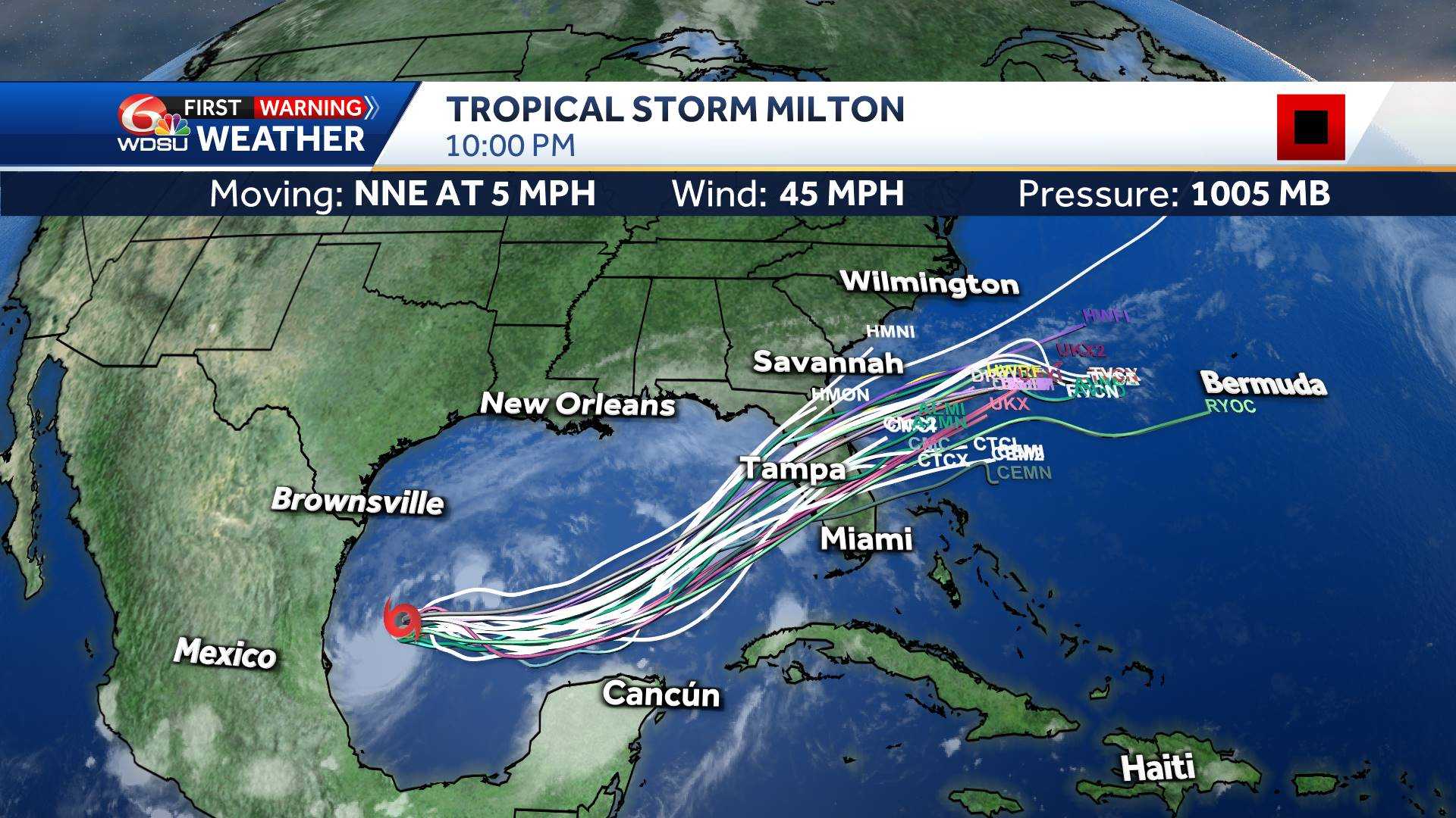
The disturbance, currently swirling around the Yucatán Peninsula, has shown signs of intensification. The NHC has assessed a 60% chance of this system developing into a tropical depression within the next 48 hours, with probabilities rising to 80% over the coming week. This means that, by early to mid-next week, we could be facing a tropical depression or even Tropical Storm Francine as the system moves into the southwestern Gulf of Mexico. Its interaction with a cold front currently pushing through Louisiana could further enhance its development, leading to an increased risk of heavy rain and potential flooding across the region.
Also Read:- Notre Dame's Stunning Loss to Northern Illinois: What Went Wrong?
- USC Faces Utah State in Key Week 2 Clash: All You Need to Know
It’s worth noting that this disturbance is not alone in the tropics. The NHC is also tracking two other waves in the Central and Eastern Atlantic. The wave in the Central Atlantic has a 50% chance of development over the next week, while the Eastern Atlantic system holds a 40% chance. However, these systems are expected to have minimal impact on Southeast Louisiana.
In the immediate future, residents of Louisiana should prepare for fluctuating weather conditions. A cold front moving through the region will bring some relief, with cooler and drier air expected to settle in. Nevertheless, showers may persist along the coast, with a gradual decrease in rain chances expected by later in the day. The North Shore could enjoy clearer skies and sunnier weather, while the greater New Orleans area, including the Superdome, should remain mostly dry, though a few sprinkles cannot be ruled out.
Looking ahead to Monday and beyond, rain is likely to make a comeback as the tropical system in the Gulf gains strength. By late Monday and into Wednesday, the chance of rain will increase significantly, reaching up to 80% by midweek. This pattern of heavy rainfall could lead to localized flooding, especially given the already saturated conditions from recent rains.
As the situation develops, it is crucial for residents to stay informed and prepared. Keep an eye on updates from local weather services and the NHC for the latest information on these tropical systems. The WDSU First Warning Weather Team will continue to monitor these developments closely and provide timely updates to help you navigate the changing weather conditions.
Read More:


0 Comments