

UK Weather Alert: Snow Expected as Arctic Chill Grips the Nation
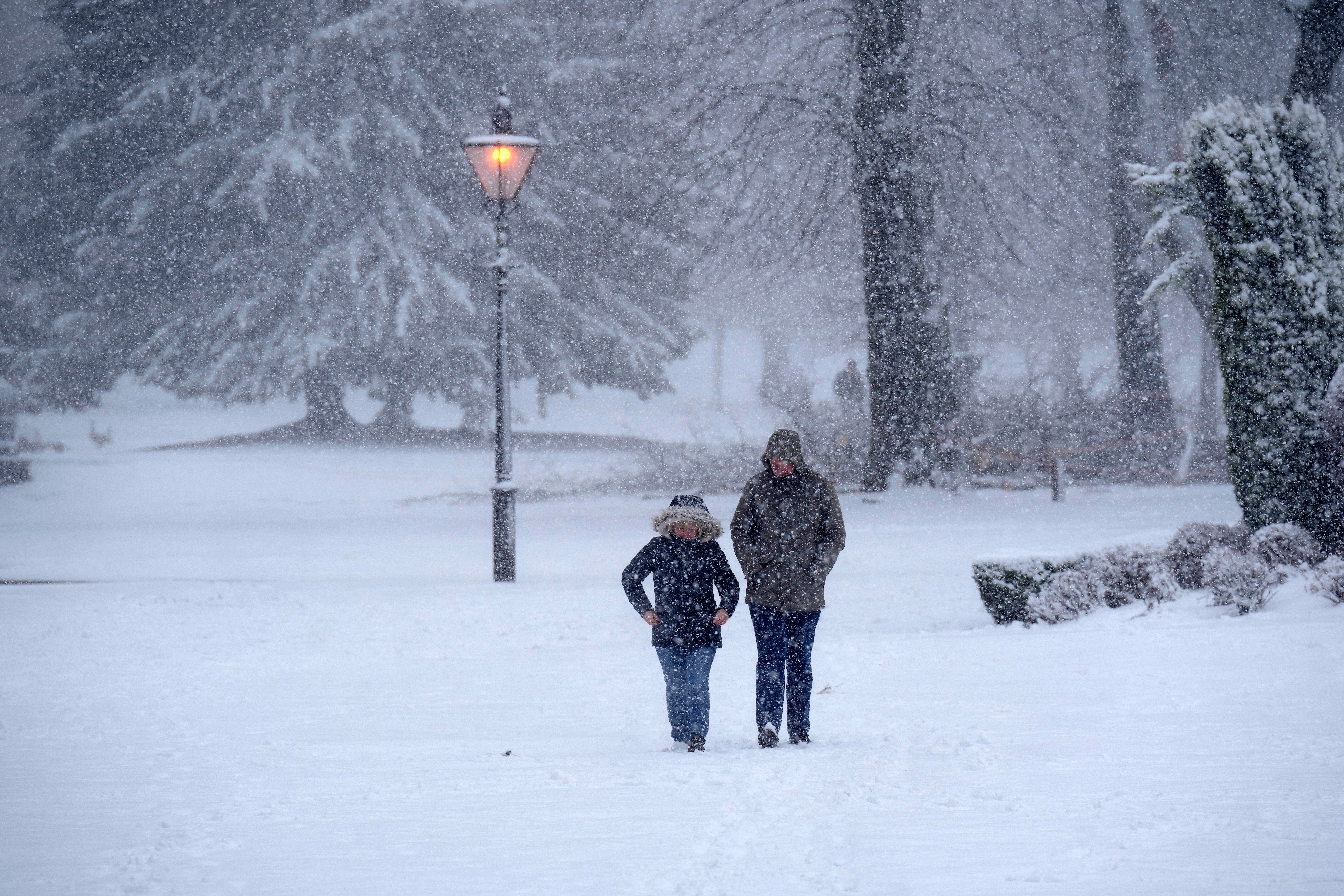
The UK is bracing for a sudden drop in temperatures, with the latest forecast from the Met Office suggesting snow showers may hit northern regions of the country as early as the start of November. This is due to a powerful Arctic blast set to sweep across the British Isles, bringing with it the first taste of winter weather for the season. Over the past few days, weather models like WXCharts have depicted the UK engulfed in icy blue, signaling an incoming wave of frosty air that’s expected to send temperatures plummeting, particularly in Scotland and parts of northern England.
The Met Office’s long-range forecast for the period between October 31 and November 9 indicates a strong likelihood of colder air affecting most areas, especially in the northern regions. According to meteorologists, high pressure will be the primary driver of this chill, bringing cooler, dry conditions along with an increased potential for frost and fog overnight. This atmospheric high pressure creates stable conditions, blocking out milder, wetter weather from the south and locking in the Arctic chill over the UK. For Scotland, particularly in northern parts, snow showers are a possibility, while other regions may see widespread frost and dense morning fog.
Also Read:- Tyler, the Creator'sChromakopia: A Chaotic, Psychedelic Dive into Midlife Reflection
- Gisele Bündchen Expecting First Child with Partner Joaquim Valente
While mid-November might offer a temporary shift, there is still uncertainty about the position and duration of the high-pressure system. If the high pressure shifts, it could allow milder air to flow in; however, many meteorologists believe colder-than-average conditions are more likely to persist across the UK during early November. The forecasts also highlight that any unsettled or rainy conditions are likely to concentrate in the northernmost parts, such as Scotland and Northern Ireland, while the south remains relatively dry.
In addition, weather models predict that by around November 13, Britain could experience a significant snow event. Maps from WXCharts display the UK virtually surrounded by frigid conditions, signaling a major cold snap that could lead to snowfall in higher elevations. British Weather Services meteorologist Jim Dale suggests that while much of the month could stay mild, certain areas, particularly in Scotland’s highest peaks, might see early snow flurries.
The forecast for the immediate days remains relatively calm, with mostly cloudy skies, light rain, and drizzle in some regions. From Monday, mild conditions may persist, especially in the south, though northern areas could encounter colder temperatures along with fog patches overnight. into Tuesday and Wednesday, much of the UK is expected to stay cloudy, with periodic rain moving through northern regions.
As Britons gear up for November, the Met Office continues to monitor the Arctic air mass and advises those in Scotland and northern England to stay prepared for potentially icy and snowy conditions. With a high likelihood of cold nights and early frost, winter coats may be essential even for those not expecting snow.
Read More:
0 Comments