

Bay Area Faces a Powerful Storm with Rain, Wind, Surf, and King Tides
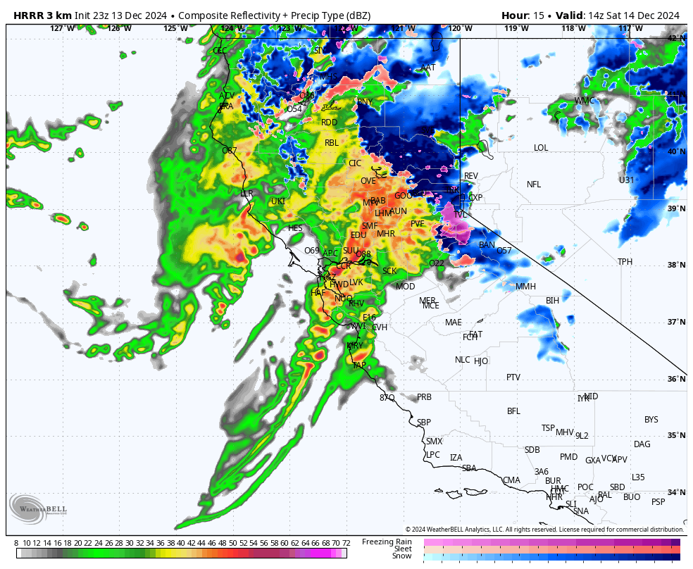
The Bay Area is preparing for a significant weather event that will impact the region this weekend. This includes a rare combination of heavy rain, gusty winds, high surf, and king tides — all coming together at once. Meteorologists are predicting intense conditions that could bring about flooding risks, especially in areas already saturated by recent storms.
According to Nicole Sarment, a meteorologist with the National Weather Service, a larger storm will move into the Bay Area late Friday and continue through Saturday. While the region saw some rain on Wednesday night, the real impact is expected over the weekend when the storm picks up speed, bringing strong winds and much heavier rainfall. Forecasts suggest that lowland areas could see about an inch of rain, but the North Bay is likely to experience much more, with up to 5 inches of rain in the highest elevations.
Also Read:- Selena Gomez Delayed Her Engagement Announcement to Avoid Over-shadowing Justin Bieber's Baby News
- Gabba's Day One Deluge: A Rainy Start to the Third Test Between Australia and India
The North Bay is a particular concern due to the region's already saturated soil, which struggles to absorb additional rainfall. This increases the risk of runoff, which could lead to flooding along rivers, streams, and roadways. A flood watch is in effect for the North Bay from Friday afternoon through Saturday. Local waterways, including the Laguna de Santa Rosa, Russian River, and Mark West Creek, are expected to be at high risk of flooding if thunderstorms or heavy showers develop.
On top of the storm, the Bay Area will experience king tides this weekend, which occur when the sun, moon, and Earth align to create higher-than-normal tides. These king tides will raise water levels between 5 and 12 feet through Monday, especially along the coast and bayshore areas. The added height of these tides, combined with waves that could reach 18 to 22 feet, means that places like San Francisco’s Embarcadero and the Mill Valley-Sausalito Bike Path are especially vulnerable to flooding.
The California Coastal Commission has asked the public to submit photos of the rising water levels during these king tides. These photos will help scientists and government officials better understand the impact of rising sea levels and how they affect local communities.
Conditions will improve by Sunday, but another round of rain is expected to hit the Bay Area early next week. While it doesn’t seem as intense as this weekend's storm, it could still bring some minor disruptions.
Thankfully, the weather looks set to improve just in time for the Christmas holiday, offering a break from the storms that have kept the region on edge. However, for this weekend, residents and visitors alike are advised to stay indoors and avoid coastal areas as the storm makes its way across the region.
Read More:


0 Comments