

Tracking Storms and Power Outages in Houston on Christmas Eve and Beyond
As Christmas Eve rolls in, Houstonians are gearing up for a mixture of festive celebrations and unpredictable weather. A cold front is expected to sweep through the area, bringing with it the possibility of rain, thunderstorms, and even some severe weather. CenterPoint Energy is already on high alert, preparing for potential power outages and storm-related disruptions. The utility company has activated its enhanced holiday staffing plan, mobilizing additional electric crews and staging extra equipment to respond swiftly if necessary.
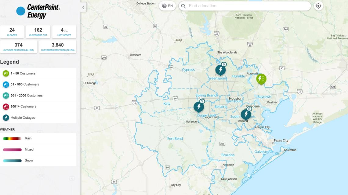
Despite the threat of severe weather, the forecast suggests that widespread damage or significant outages are unlikely. CenterPoint's meteorology manager, Matt Lanza, reassures customers that while high wind gusts and lightning could cause temporary disruptions, the risks are relatively low. However, the company is still taking precautions to ensure a quick response, including ongoing communication with customers throughout the night. It's a good idea for residents to make their own outage plans just in case, and keep an eye on CenterPoint’s new outage tracker, which has seen improvements since its struggles during Hurricane Beryl. The tracker, now cloud-based and mobile-friendly, offers updates every five minutes, weather integrations, and a user-friendly interface for tracking outages by county, city, or ZIP code.
Also Read:- Dave Portnoy’s Generous Christmas Gift Saves Baltimore Pizzeria
- Notre-Dame de Paris Celebrates Its First Christmas Masses After the 2019 Fire
As for the weather itself, the cold front moving through Central Texas is expected to bring unsettled conditions starting on Christmas Eve night. While the day may remain warm and breezy, showers are likely to develop as the front pushes through, with the possibility of storms intensifying overnight. Hail, strong winds, and lightning could be part of the storm system, although the threat of tornadoes is minimal. The strongest storms are expected to develop between 3 PM and 11 PM, with the potential for localized flooding, particularly east of Interstate 35.
Christmas Day itself may offer some relief, with lingering drizzle giving way to partly cloudy skies by the afternoon. Temperatures will range from the mid-50s in the eastern parts of the city to the low 60s to the west. But don’t get too comfortable, as another round of severe storms could arrive Thursday, bringing gusty winds and large hail. Despite the stormy conditions, the holiday spirit remains strong, and with the right preparations, Houstonians can navigate the weather and enjoy their celebrations with minimal disruption.
For those planning to be out and about, including attending the Texans game on Wednesday, the forecast suggests clearing skies and warmer temperatures by midday, making for a drier, more pleasant afternoon. Even though rain and storms will impact parts of the region, the most severe weather will be moving out before the festivities of Christmas morning get underway. With a little weather luck and timely preparations, this Christmas could still be one to remember, despite the stormy conditions that are making their presence felt across the city.
Read More:


0 Comments