

Winter Weather Advisory: Snowstorm Expected to Bring 2-4 Inches by Friday Evening
As winter continues to make its presence felt, another round of snow is headed our way, bringing with it a Winter Weather Advisory that is now in effect until Saturday morning. If you’ve been enjoying a break from the snow, you may want to put your shovel back to work, as accumulating snow is set to hit our region starting around midday Friday. This could cause some travel disruptions, especially as we move into the evening hours.
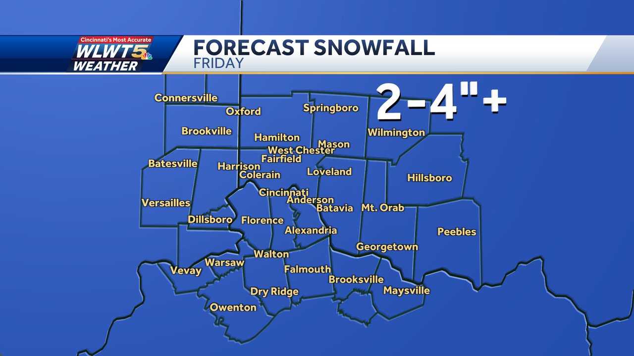
Meteorologists are forecasting that the snowfall will start to increase around lunchtime, with some areas seeing snowflakes begin to fall by mid-to-late morning. By the afternoon, the snow will become more widespread, intensifying as it moves closer to the evening commute. While the snow will start light, we can expect it to pick up quickly, with 2 to 4 inches of snow possible by the time we reach the evening hours. Some locations could see closer to 5 inches depending on where the heaviest snow bands set up.
Also Read:- Melbourne Victory Set to Battle Western United in Thrilling Friday Night Clash
- Fulham Cruise into FA Cup Fourth Round with a 4-1 Victory over Watford
What’s causing all this snow? This particular winter storm is actually the result of two systems combining. An arctic front from Canada is bringing in the cold air, while a second system from Texas is providing extra moisture. The intersection, or “phasing,” of these two systems is what leads to the heavier snow, and while this is expected to happen further east of our area, it’s possible that we could see higher snowfall totals if that phasing occurs closer to us.
If you're planning on hitting the roads after work or school, be prepared for slick conditions. Snow-covered roads will make travel more difficult, particularly from late afternoon through the evening. The heaviest snow will likely occur between 5 p.m. and 9 p.m., coinciding with the evening rush hour, so delays are expected. If you have any travel plans during that time, it's best to leave extra time for your journey.
The snow will continue through about midnight before becoming more scattered. By early Saturday morning, most areas will have received around 2 to 4 inches of snow. If you're hoping for a break from the snow, you’ll get your wish by the weekend, as Saturday will dry out, though temperatures will remain cold. Be aware, however, that another snow chance is on the horizon for Monday.
As for today, temperatures are expected to stay cold, with wind chills near 0 degrees in the morning. Snow will gradually build through the day, with temperatures topping out around 25°F. If you're heading out, make sure to dress warmly and keep an eye on the road conditions.
With this new snowstorm moving in, travel disruptions are likely, especially for those planning to be out on the roads later in the afternoon and evening. Whether you’re driving home from work or heading out for an evening out, it’s a good idea to stay updated on the latest weather reports and prepare for slower, more hazardous travel conditions. Stay safe out there and remember that winter weather isn’t done yet—more snow is in the forecast next week!
Read More:


0 Comments