

Possible Tornado Threat Looms Over Monroe County – Take Shelter Now!
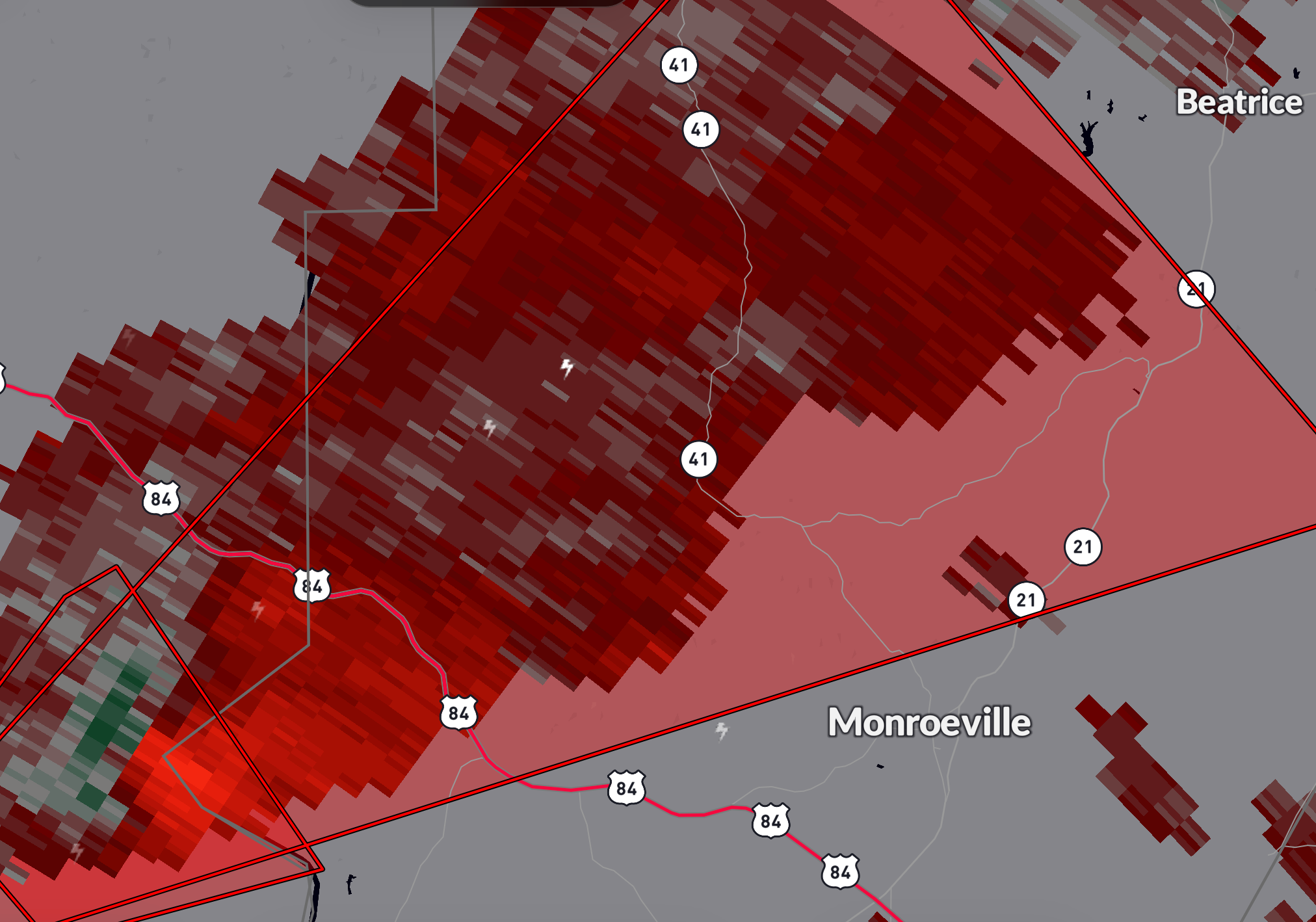
Good evening, everyone. If you're in Monroe County or nearby areas in southwestern Alabama, this is an urgent weather update you need to hear. A severe thunderstorm capable of producing a tornado has been detected, moving at a rapid 55 mph. The storm, spotted around 9:47 PM CST, is currently 9 miles southeast of Whatley and about 14 miles northwest of Frisco City. Strong rotation has been identified near the Alabama River, right along the Clarke/Monroe County line.
Also Read:- Celtic's Brave Fight Falls Short as Bayern Clinch 2-1 Victory
- Cyclone Zelia Hits Category 5, Port Hedland Braces for Impact
A Tornado Warning is now in effect until 10:15 PM CST for northwestern Monroe County and east-central Clarke County . That means conditions are highly favorable for a tornado to form, if one hasn’t already. Radar is picking up clear signs of rotation , and this storm could produce flying debris, roof damage, shattered windows, and significant harm to vehicles and mobile homes. Tree damage is also highly likely.
Now, if you’re in the warned area, do not wait for visual confirmation of a tornado —especially at night, when they’re nearly impossible to see. Seek shelter immediately . Move to an interior room on the lowest floor of a sturdy building and stay away from windows. If you're in a mobile home or outside, find a safer structure as soon as possible. Tornadoes can form quickly and without much warning, so every second counts.
Thankfully, this storm is expected to pass mainly over rural areas, but that does not mean anyone should take this lightly. Even if you are not directly in the warning zone, remain alert, as conditions can change rapidly.
We will continue to monitor this situation closely, and if you need updates, keep an eye on official weather channels, alerts, and emergency broadcasts. Stay safe, take cover, and let’s hope for the best as we track this storm.
Read More:


0 Comments