

Strong Winds and Heavy Rain Hit Metro Vancouver – Stay Prepared!
Hey everyone, if you’re in Metro Vancouver or anywhere along the South Coast of B.C., you’ll want to pay close attention to this. Environment Canada has officially extended its wind warning for the region, and we’re in for some intense weather over the next day or so.
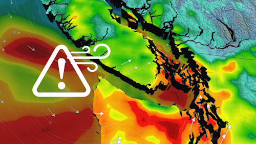
A powerful storm system is sweeping through, bringing strong gusts, heavy rain, and even the possibility of travel disruptions and power outages. Forecasters are calling for wind speeds of over 90 km/h in some coastal areas , particularly around Greater Victoria and exposed sections of Vancouver Island. Meanwhile, areas like Tsawwassen, Boundary Bay, Delta, and White Rock could see gusts exceeding 70 km/h . That’s some serious wind power, and it could make for dangerous conditions on the roads, as well as interruptions to ferry services.
Also Read:- HMRC Fuel Rate Changes: Petrol and Diesel Car Owners Face Higher Costs
- Remembering Roberta Flack: A Soulful Legend Who Touched Millions
Now, this storm isn’t just about the wind—it’s bringing a lot of rain too. Parts of West Vancouver Island are expected to get 30-50 mm of rain , while North Vancouver could see around 20-30 mm . With all that precipitation, flooding and water pooling on roads could be a concern, so be cautious if you’re driving.
Another major issue? Avalanche risk. Warmer temperatures and rising freezing levels are making the snowpack unstable, and experts are warning of a high avalanche danger rating for the alpine areas. Avalanche Canada is urging people to stay out of avalanche terrain, as triggering one could have severe and deadly consequences . If you’re planning any mountain activities, it’s best to rethink your plans.
The peak of this storm will hit Monday night through early Tuesday morning , with the worst winds happening between 10 p.m. and 8 a.m. If you haven’t already, make sure your devices are charged in case of power outages, secure any loose objects outside, and prepare for possible travel delays.
On the bright side, things are expected to calm down by mid-week, with a return to drier and milder conditions. But don’t get too comfortable—forecasters say we could see another round of unsettled weather before March really kicks in.
Stay safe out there, and keep an eye on updates from Environment Canada and The Weather Network. If you’re in an affected area, take the necessary precautions and be prepared for a blustery start to the week!
Read More:


0 Comments