

Freezing Rain Causes Massive Power Outages Across Ontario
Hey everyone, let's talk about this massive weather event that’s gripping Toronto, the GTA, and beyond. A major ice storm has left over 100,000 people without power across Ontario’s cottage country, and the freezing rain warning is still in effect for Toronto and many surrounding areas.
Hydro One has reported widespread outages stretching from Tobermory and Gravenhurst all the way to Peterborough and the Kawartha Lakes. As of late last night, the utility company was handling over 1,400 separate outages, affecting nearly 125,000 customers. Many of those impacted may have to endure a powerless night as crews work tirelessly to restore service.
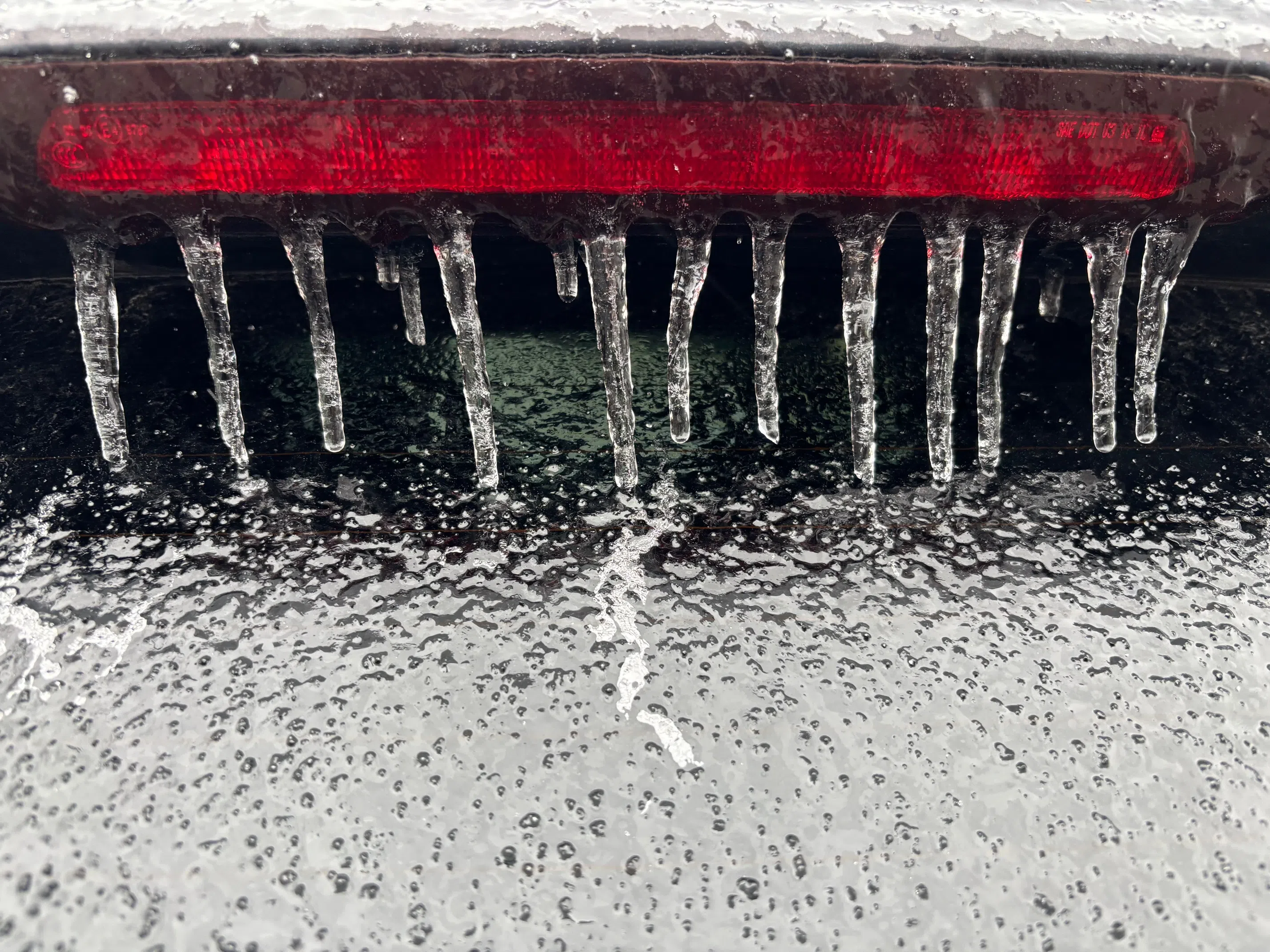
The storm came after Environment Canada issued freezing rain warnings covering vast areas of Ontario and Quebec. The affected regions include the northwestern shores of Lake Huron, reaching as far south as Burlington, Ontario, and extending all the way east to Lac-Mégantic, Quebec. Some areas—particularly around Bracebridge, Midland, Orillia, and Peterborough—are expected to receive between 10 to 20 millimeters of ice accumulation, with some localized pockets seeing as much as 40 millimeters.
Also Read:- Bruce Glover, Iconic James Bond Villain and Veteran Actor, Passes Away at 92
- Buffalo Bills Secure Key Talent with Major Contract Extensions
In Toronto, the freezing rain has already started to coat surfaces in a dangerous layer of ice. Environment Canada warns that the accumulation could reach up to 2 to 4 millimeters in the city, leading to power outages, hazardous driving conditions, and tree branches snapping under the weight of the ice.
Public transit is also on high alert. TTC crews have been working around the clock, salting stations and applying anti-icing agents to the tracks to keep the transit system running smoothly. Meanwhile, the Toronto and Region Conservation Authority has issued a water safety warning, as the heavy rain could cause flooding near streams, rivers, and low-lying areas.
Temperatures are hovering around the freezing mark, between 0 and 1 degree Celsius, with winds gusting up to 40 km/h. The good news? Things should start to warm up by Sunday, with temperatures climbing to about 5 degrees. However, with the warming trend comes more rain, which could add to the potential for localized flooding.
Authorities are urging people to stay off the roads unless absolutely necessary. Provincial police have warned that road conditions will remain slippery and unpredictable, making travel extremely dangerous. The City of Toronto has dispatched crews to clear catch basins and prepare for potential flooding, while salters are on standby, ready to combat any fresh ice buildup.
If you're in one of the affected areas, make sure you stay indoors as much as possible, avoid downed power lines, and check in on vulnerable neighbors. And for those without power, keep your devices charged when possible and have emergency supplies on hand.
Stay safe out there, and we’ll keep you updated as the situation develops.
Read More:


0 Comments