

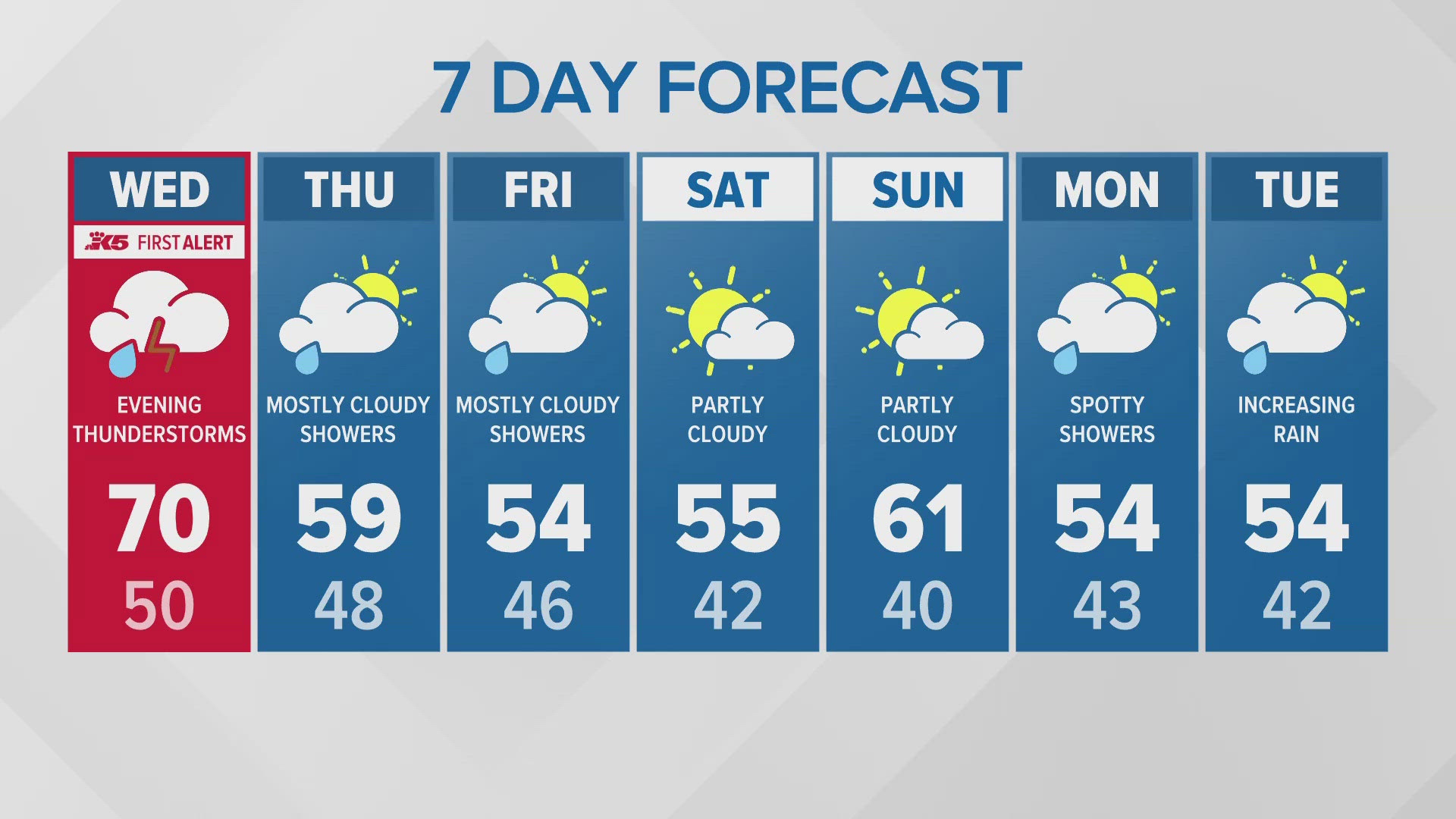
Severe Thunderstorms and Rare Large Hail Possible in Western Washington
Hey everyone, let’s talk about the latest weather alert that’s got everyone in Western Washington keeping a close eye on the skies. We’re looking at a strong potential for thunderstorms this Wednesday, and it’s not just any storm system—there’s a real risk of severe weather, including hail, strong winds, and even a slight chance of tornadoes.
Here’s what’s happening: A warm, unstable air mass is currently sitting over the region, and as it interacts with a cold front moving in, it’s creating the perfect conditions for thunderstorms to develop. Temperatures are expected to be unseasonably warm, hitting the 60s, which only adds more energy to the atmosphere.
According to the National Weather Service, we’re looking at a “marginal risk” of severe storms, with some areas seeing isolated intense weather. There’s a 15-29% chance of hail larger than an inch from Everett down the I-5 corridor into Oregon, and even a 10% chance of hail as large as two inches. While that may not sound like a big deal at first, remember—hail of that size can do some serious damage to cars, homes, and crops.
Also Read:- Pakistan vs New Zealand 2025 – A Thrilling Cricket Battle Unfolds
- US Attorney Jessica Aber’s Tragic Passing: A Shocking Loss
And let’s talk wind. Some areas in Western Washington could see gusts of over 58 mph, which is strong enough to knock down trees and power lines. But what’s even more concerning is that there’s a small but real 2-4% chance of tornadoes forming along the I-5 corridor. While tornadoes are rare in this region, they’re not impossible, so it’s always good to be prepared.
So when should you be on alert? Storms are expected to develop around 4 p.m. and continue into the night until about 10 p.m. If you’re heading out during that time, be cautious, and if you hear thunder, remember the rule—when thunder roars, go indoors!
For those wondering how these storms form, it all comes down to three main ingredients: moisture, unstable air, and something to lift that air up into the atmosphere. As warm air rises, it carries water vapor that cools and condenses, forming storm clouds. If conditions are just right, ice particles collide and build up enough electric charge to create lightning, and with lightning comes thunder.
And here’s something you don’t hear every day—forecasters say there’s a chance of unusually large hail. While hail isn’t unheard of in Washington and Oregon, it’s more common in the Midwest and South. The largest recorded hailstone in Oregon was four inches in diameter, back in 1995. Could we see something like that this time? It’s unlikely, but forecasters aren’t ruling out hail up to 2.5 inches in some places.
So what should you do? Stay updated with local forecasts, make sure your car is in a safe spot, and be ready to take cover if needed. Keep an emergency kit handy, just in case.
Stay safe, and keep an eye on the sky!
Read More:


0 Comments