

Strong Storms Possible in Austin Tonight—Stay Alert!
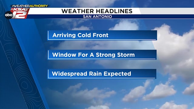
Good evening, everyone. If you’re in the Austin area, keep an eye on the sky because we have some potentially strong storms rolling in tonight. A Severe Thunderstorm Watch has been issued for most of Central Texas until 1 a.m., and while there’s no tornado risk, we’re still looking at a real possibility of gusty winds and large hail.
What’s Happening Now?
A cold front is sweeping into the region, bringing with it storm activity that could turn severe. We’ve already seen warnings issued for several areas, including Travis, Hays, Bastrop, Comal, and Bexar Counties . Some locations have reported hail as large as golf balls, and wind gusts reaching up to 60 miles per hour . If you’re in the affected zones, stay indoors and away from windows.
Storm Timing
Here’s how things are shaping up for tonight:
-
9 PM – 10 PM : Storms begin moving in from the west.
Also Read: -
10 PM – 11 PM : Austin metro area could experience strong thunderstorms.
-
Midnight – 2 AM : Storms shift eastward and begin clearing out of the region.
If you have outdoor plans, it’s best to move them inside. Keep your weather alerts turned on, and make sure you have a safe place to shelter if needed.
Looking Ahead
After tonight’s storms, we get a brief break. Monday through Wednesday will be dry but warm, with highs near 90°F . However, the real weather action comes Thursday and Friday . Those are shaping up to be our best chances for widespread rainfall —something we really need given our ongoing drought conditions. Some areas could see 1 to 2 inches of beneficial rain , which is fantastic news.
Stay Prepared
This is a great reminder to have a weather app handy—whether it’s the KSAT Weather Authority App or your favorite local source. If you’re seeing any hail or intense conditions in your area, share your photos safely and keep your community informed.
That’s the latest for now—stay safe, and we’ll keep you updated as the storms develop!
Read More:


0 Comments