

Tornado Watch Issued for Louisville as Severe Storms Threaten Area
Hey folks, we’ve got a serious weather situation unfolding tonight. A tornado watch has been issued for a large portion of our viewing area, including Louisville Metro , and will remain in effect until midnight . On top of that, a severe thunderstorm watch is in place for our northern and northeastern communities until 1 a.m. If you're in these areas, now is the time to stay weather-aware and have your safety plan ready.
Also Read:- Referee’s Unfortunate Fall Gifts Maple Leafs a Crucial Goal
- Keith Urban's "High And Alive" Tour Set to Rock Xcel Energy Center
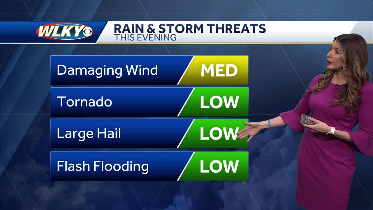
Right now, we’re tracking strong to severe storms moving in from the west. These storms are packing damaging winds of up to 70 mph , heavy rainfall , and possible hail . While we don’t have a confirmed tornado on the ground at this moment, radar is detecting significant rotation , which means a tornado could form at any time . If you’re in the northwestern parts of Jackson County , including areas like Kurtz, Freetown, Spraytown, and Jonesville , take immediate action and get to your safe place . The storm is moving quickly to the northeast at speeds of around 45 to 50 mph .
If you don’t have a basement, the safest spot is the lowest level of your home, in an interior room, away from windows . Put as many walls between you and the outside as possible to protect yourself from flying debris .
Looking at the bigger picture, this entire storm system is part of a major low-pressure system sweeping across the country. Believe it or not, this same system is producing blizzard conditions in Nebraska and Wisconsin, while we’re dealing with springtime severe storms here in Kentucky and Indiana.
These storms are still about an hour and a half away from reaching downtown Louisville , but they are expected to hold their strength. So, if you’re in the city, don’t let the calm weather fool you—conditions will change fast as we approach 10 to 10:30 p.m.
The National Weather Service has also issued severe thunderstorm warnings for several counties. Even outside the tornado-warned areas, we’re seeing reports of downed power lines and trees , so power outages are possible. Straight-line winds from these storms can cause just as much damage as a weak tornado.
Our team of meteorologists is closely tracking these storms, and we will keep you updated throughout the night . If a tornado warning is issued for your area, take it seriously. Stay indoors, stay away from windows, and do not wait to take shelter .
As always, have multiple ways to receive alerts —whether it’s through the WLKY app, NOAA Weather Radio, or emergency notifications on your phone . We’ll continue to keep you informed as the situation develops. Stay safe, and we’ll check back in soon!
Read More:
0 Comments