

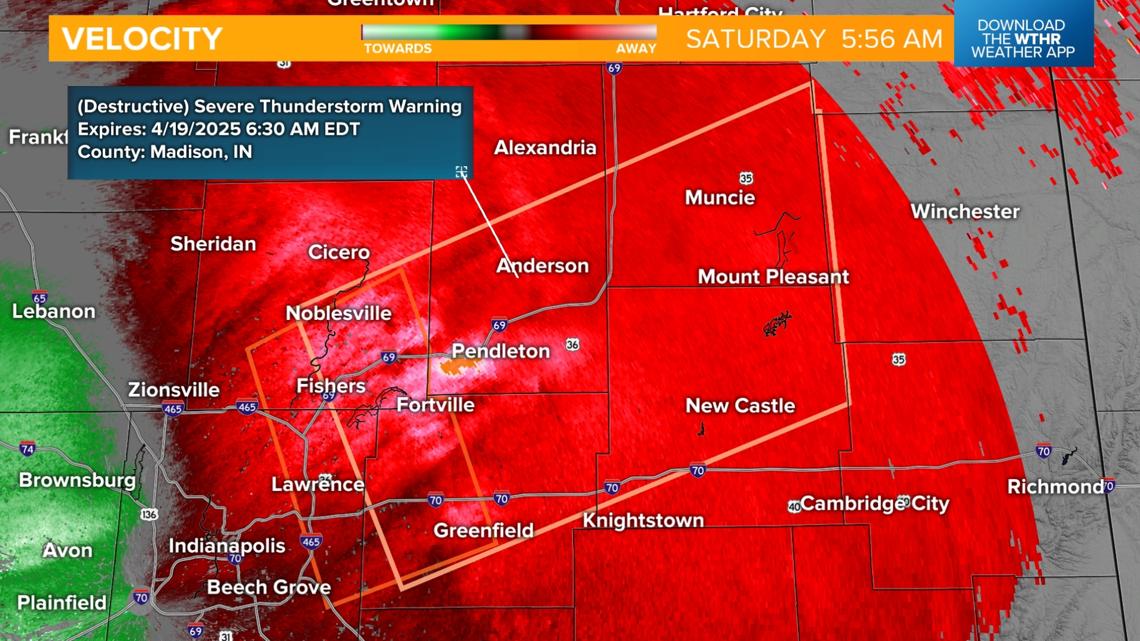
Intense Storms Hit Indiana Before Dawn, Now Warnings Have Expired
This morning was anything but quiet here in Indiana. If you were awake early—or were jolted out of bed by thunder, heavy rain, or even emergency alerts—you weren’t alone. A series of severe thunderstorm warnings swept through central and eastern Indiana just after 2 a.m. and lasted well into the early morning hours. Now, those warnings have expired, but the weather story today still isn’t over.
The National Weather Service (NWS) issued multiple warnings starting as early as 2:15 a.m., when conditions began shifting rapidly. What started out fairly calm quickly turned dangerous as strong storms moved in from Illinois, heading northeast at around 70 mph. By 5 a.m., several counties were under active warnings. We're talking places like Boone, Hamilton, Hancock, Hendricks, Johnson, Marion, Morgan, and more. And this wasn’t just typical April rain—these storms came packed with serious wind gusts, some clocked by radar at up to 90 mph, particularly around the Geist area.
Also Read:- Miami Heat Make NBA History With Play-In Comeback Against Hawks
- Blades Back in the Fight After Crucial Cardiff Win
The wind was so powerful that the Indianapolis Metropolitan Police Department reported downed power lines on Country Club Road, forcing both directions of traffic to shut down in that area. Residents were urged to avoid the scene and find alternate routes. And it's no wonder—over 11,000 customers across Indiana lost power this morning, according to AES Indiana and Duke Energy.
Some of the storm warnings even carried a rare "destructive" tag. That’s what triggered the outdoor warning sirens in places like Hamilton County. A lot of people assume those sirens are only for tornadoes, but destructive thunderstorm warnings can also activate them due to the high potential for wind damage and large hail.
By around 7:30 a.m., the warnings had expired for most areas, and the worst of the weather began to move out. However, forecasters from WTHR say scattered downpours and non-severe storms are still expected through midday. The atmosphere is still charged, so it's a good idea to keep an eye on the radar if you have outdoor plans today—like the Carmel Marathon, which was actually cancelled due to this morning's conditions.
It’s one of those days where Indiana weather really reminds us who's boss. Luckily, things should gradually settle as the day goes on, with most of the severe risk tapering off. But if today showed us anything, it’s how quickly these spring storms can escalate. Stay weather-aware, charge your devices, and be ready to change plans when Mother Nature demands it.
Read More:


0 Comments