

DC Under Severe Thunderstorm Alert: Damaging Winds and Tornado Threat Loom
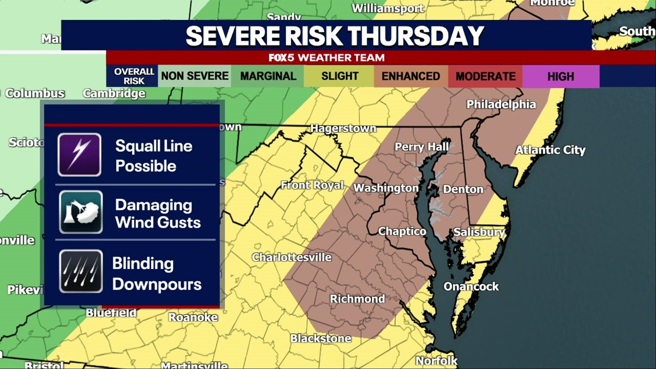
Hey everyone, just a quick but important heads-up about the weather today here in the D.C. region. If you haven’t checked the forecast yet, you’ll definitely want to tune in because things are looking pretty intense this afternoon and evening. A Severe Thunderstorm Warning has been issued, and it’s not just the usual rain and thunder. We’re talking about the potential for damaging winds up to 70 mph , heavy downpours , large hail , and yes— even an isolated tornado threat in some areas.
Also Read:- Messi’s Miami Clash with Porto Lights Up Club World Cup Stage
- Jasmine Crockett Defends Biden’s Mental Sharpness and Sparks Debate on Trump Supporters
Right now, most of the DMV is under a Severe Thunderstorm Watch until 9:00 p.m. , and many parts, especially near the I-95 corridor, are also under a Flood Watch . This includes places like Montgomery County, Prince George’s, Arlington, Alexandria, and all across D.C. itself.
So here’s the timeline: the day started off humid and foggy, but that calm won’t last. Showers might start popping up between noon and 2 p.m., but the real action is expected between 4 p.m. and 7 p.m. That’s when a fast-moving line of storms is projected to move through. And that’s where we could see the strongest impacts—damaging winds that can knock out power, down trees, or even cause structural damage, not to mention the risk of flash flooding in low-lying areas.
This is a great time to secure outdoor items , check your emergency alerts , and be ready to move to a safe interior space if a warning is issued for your area. Tornadoes might be isolated, but they are still on the table. If you’re commuting home later or planning to be outside, please reconsider or stay weather-aware with mobile apps and alerts.
The silver lining? Things are expected to clear out by late tonight , and Friday looks much calmer—sunny skies, less humidity, and highs in the upper 80s. That calm trend will continue into the weekend, though things heat up again fast. We could be heading into a potential heatwave next week with temps pushing into the 90s and possibly the triple digits.
So for now, stay alert, stay safe, and if you're inside watching this, maybe wait out the worst of it before heading out. This could be one of those afternoons where a little caution goes a long way.
Read More:


0 Comments