

Storm Alert: Southern Quebec Braces for Intense Weather This Wednesday
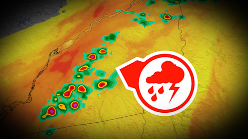
Hey everyone, quick weather update that you’ll definitely want to pay attention to if you’re in southern Quebec. MétéoMédia has issued a serious heads-up: we’ve got a stormy Wednesday coming our way. The forecast points to a pretty active afternoon and evening, especially for regions like the Capitale-Nationale and areas in the far south of the province. It’s not just light rain—we’re talking possible thunderstorms, heavy showers, small hail, and strong wind gusts sweeping across the region.
Now, early Wednesday morning, lightning had already made its presence known in parts of western Quebec. But the main action is expected later in the day, particularly in the afternoon and evening. Storm cells of moderate intensity are on the radar, and they could roll in as the day progresses—especially from Montreal through to Montérégie, the Beauce, and all the way to the eastern coast of Gaspésie.
Also Read:- Juneteenth 2025: Celebrating Freedom Amid Political Rumblings
- ARB Gives the Kia Tasman a Bold Makeover for the Aussie Outdoors
What’s stirring all of this up? Well, a passing weather front is creating just the right setup: heat, instability, moisture—pretty much all the classic ingredients needed to trigger convection and ignite storm formation. There’s a lot of energy in the atmosphere right now, and it looks like nature might throw a bit of a lightning party starting in the afternoon.
And let’s not forget the humidity. It’s going to feel heavy—really heavy. Humidex values could climb to a sticky 37 degrees, particularly in places like Montreal, Sherbrooke, and Gatineau. That muggy, uncomfortable air is sticking around at least through Thursday, so if you thought today felt like a sauna, brace yourself.
What’s more, Thursday could get even more intense. Today might just be a warm-up act. According to Environment Canada, Thursday’s system could bring stronger storms, more sustained rain, and cooler temps in the central and northern parts of the province, though the south will still stay pretty warm. We're looking at anywhere from 20 to even 60 millimetres of rain in regions like Abitibi-Témiscamingue, Outaouais, Quebec City, and the Saguenay area.
So what should you do? Keep your umbrellas handy, charge your phones in case of outages, and stay weather-aware through the afternoon and evening. And if you’re planning outdoor activities—might be smart to move them indoors. There’s a good chance the sky will put on a loud, wet show.
That’s your weather watch for Wednesday, straight from MétéoMédia’s latest. Keep safe out there and stay tuned—Thursday could have even more surprises in store.
Read More:


0 Comments