

Storms on Standby: Dallas Braces for Another Wet and Wild Weekend
Hey everyone, just a quick weather update because if you’re in or around Dallas, you’ll definitely want to pay attention to what’s coming our way. After a brief break from the rain, it looks like the storm train is getting ready to roll back into North Texas—and with it comes a renewed threat of severe weather, heavy rain, and even the possibility of flooding.
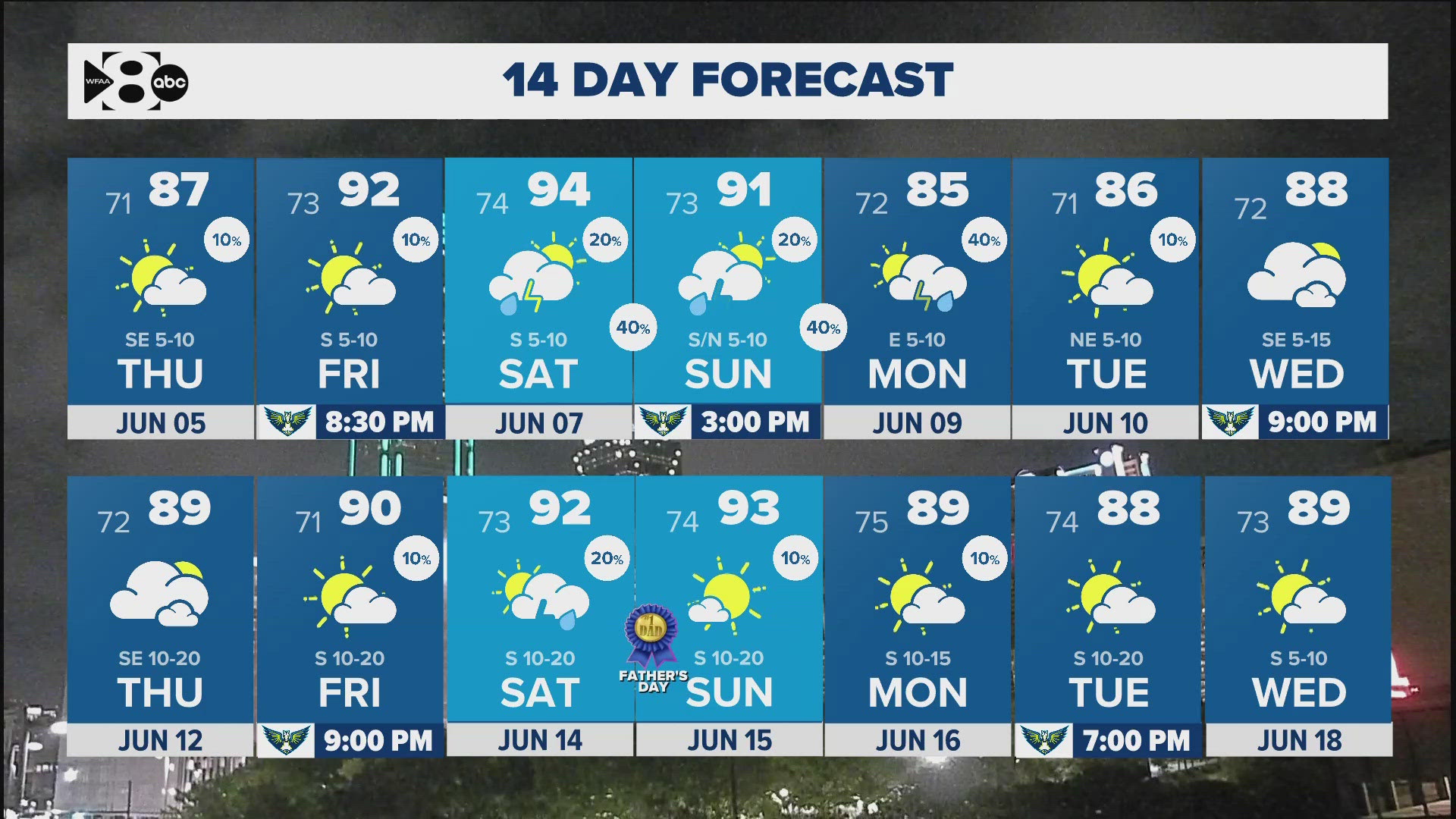
We started the week with cooler temps and some scattered showers, but now, as we push toward the weekend, the pattern is shifting again. It’s that classic North Texas summer setup—heat, humidity, and instability. The last 24 hours brought some localized downpours, with some areas recording over 4 inches of rain. While there weren’t too many reports of hail, flooding became a concern, especially west of the Metroplex.
Thursday and Friday are expected to be warmer, with temperatures climbing into the upper 80s and low 90s. But don’t let the sunshine fool you—by Saturday night into Sunday, we could be dealing with a fresh round of strong storms. That’s when the cold front that’s been lingering to our north is expected to sag south and fire up another round of thunderstorms. Some of those could pack a punch—think large hail and damaging winds.
Also Read:- Solving Today’s Wordle—Hints, Clues, and a Surprising Answer for June 4, 2025
- Tragedy in East Windsor: 71-Year-Old Woman Fatally Struck by Train
The bigger issue, though, may come early next week. Forecast models are hinting at that cold front stalling right over North Texas. And when that happens? We’re talking about multiple waves of rain moving through, back-to-back. If that sets up just right—or just wrong, depending on how you look at it—we could see significant flooding potential across the region by Monday and Tuesday.
So here’s what you need to know right now: Keep your umbrella handy, download your favorite weather app, and stay alert. We’re not necessarily in for a complete washout every day, but these hit-and-miss storms can pop up quickly and bring dangerous conditions with them. And with the state already activating emergency resources, it’s clear that officials are taking this threat seriously.
The Texas Division of Emergency Management has deployed swiftwater rescue teams and game wardens, and they’re reminding everyone to be vigilant—especially when it comes to flash flooding. Never drive through water-covered roads, even if they don’t look too deep. It’s just not worth the risk.
In short, we’ve got another few days of unsettled, unpredictable weather ahead. Make the most of the dry hours, enjoy the brief sunshine when it shows up, but don’t let your guard down. This pattern is active, and we’ve seen how quickly conditions can change.
Stay safe out there, North Texas—more rain is coming, and it’s bringing a whole lot of thunder with it.
Read More:


0 Comments