

Sydney Freezes Through Its Coldest Day Yet in 2025
Hey everyone, just wanted to jump on here and talk about what’s going on with Sydney’s weather today—because honestly, if you’ve stepped outside at all, you already know: it is freezing . We are officially seeing what’s shaping up to be Sydney’s coldest day of the year so far.
Now, we’re used to mild winters here in Sydney. A chilly morning, a sunny afternoon—that’s our rhythm. But today? It’s different. We woke up to icy winds, relentless showers, and this biting cold that just won't quit. At 9am this morning, the temperature in Sydney was sitting at just 10.4°C. But with the wind chill factored in, it actually felt like a frosty 5.3°C. That’s right—5.3°C in the middle of Sydney!
Also Read:- Sargassum Seaweed Crisis Hits Record Highs Across Caribbean and Atlantic
- ‘Snowfall’ Spinoff Heats Up with Fresh Faces and High Expectations
The forecast max is only about 15°C today, which is already a couple degrees below our average for June. But when showers are this constant and the clouds keep the sun away, it could easily stay cooler than predicted. And it’s not just the city centre feeling the chill. Some suburbs are seeing conditions closer to what you’d expect in places like Hobart or Canberra. Out west and in higher altitudes—like Terrey Hills or Mount Boyce in the Blue Mountains—it’s even colder. We’re talking sub-zero feels like temperatures in places like Mount Boyce where it was just 2.5°C with gusty winds making it feel like nearly -3°C.
And yes, there’s snow—not in the CBD obviously, but light snow has been reported in parts of the Blue Mountains. A proper winter wonderland for early June.
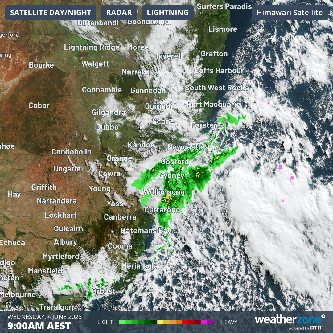
This deep chill is all thanks to a big polar airmass pushing up from the south, carried in by strong southerly winds. It’s also being intensified by a low-pressure system spinning over the Tasman Sea, sitting between NSW and New Zealand. That system’s driving strong winds, showers, and even hazardous surf right along our coast—from Byron to the Illawarra.
If you're heading to the beach—first of all, you're brave—but be careful. Surf warnings are in place across most of the NSW coastline, with swell conditions described as hazardous.
And while Sydney’s shivering, the snowfields in NSW and Victoria are already getting some early action. Up to 2cm of snow has fallen in parts of the alpine regions, and heavier snow is expected just in time for the official start of the 2025 snow season this weekend. Perfect timing, right?
Bottom line: today’s a triple-layer kind of day. If you’re out and about, it’s coats, jumpers, and probably a warm drink in hand. And if you’re lucky enough to be home—maybe don’t stray too far from the heater.
Stay warm, Sydney!
Read More:


0 Comments