

Extreme Heat Warning Issued as Dangerous Temperatures Grip the Region
Hey everyone — I just wanted to jump on here and give you all a heads-up about some serious weather that’s heading our way. We’re looking at an extreme heat event next week that could really impact day-to-day life across much of Northwest Missouri and Northeast Kansas.
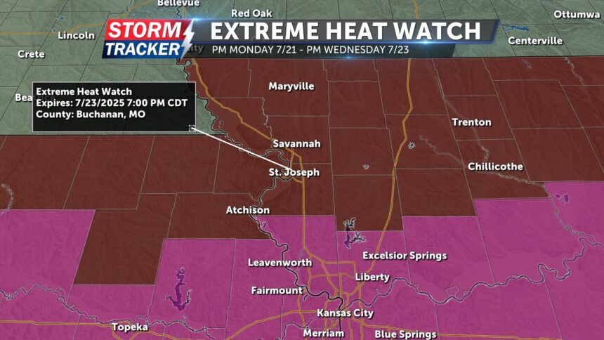
The National Weather Service has officially issued an Extreme Heat Watch from Monday, July 21 through Wednesday, July 23 for a broad area. This includes counties across Northeast Kansas like Doniphan and Atchison, and pretty much all of Northwest Missouri, including places like Buchanan, Clinton, Andrew, Nodaway, and many more.
If you’re in the Kansas City metro area or anywhere through central and southern Missouri or eastern Kansas, it's even more serious — an Extreme Heat Warning is already in place for those locations. That means the heat isn’t just likely — it’s almost guaranteed to be dangerous.
Also Read:- Trump’s Warpath Over Epstein Story Reveals Deeper Panic
- Lions Edge Bulldogs in Thriller, But Finals Questions Remain
Now when we talk about extreme heat, we’re not just talking about discomfort. Forecasts are showing heat index values between 105 and 110 degrees , and even overnight temperatures might not drop below the mid to upper 70s , which makes it hard for the body to recover. That kind of sustained heat is no joke. Heat-related illnesses like heat exhaustion and heat stroke become much more likely under these conditions.
So here's the deal — take precautions now . Make sure you're staying hydrated. Keep water with you at all times. If you can, stay indoors in air conditioning, especially during the hottest parts of the day. Avoid prolonged sun exposure, and if you have elderly relatives, neighbors, or anyone who might be vulnerable, please check in on them regularly. Extreme heat can be especially hard on children, older adults, and people with health conditions.
And even though there’s a slight chance for isolated thunderstorms this weekend, don’t count on any rain to cool things down — this is looking like a full-blown heat wave . Meteorologists are saying that by the middle of the week, much of the region could be in the triple digits, with actual temps sitting in the high 90s and heat indices even higher.
We’re also expecting a weather pattern known as a heat dome to form — basically a ridge of high pressure that traps hot air over the area, making it difficult for temperatures to cool off at night. That just increases the risk for heat-related stress over several days in a row.
This kind of heat event isn’t just a weather story — it’s a public safety concern. So, whether you’re commuting, working outside, or even just trying to enjoy some summer activities, be smart and stay safe. Keep your local weather apps handy, pay attention to alerts, and take this heat seriously.
We’ll keep an eye on things as they develop, and I’ll update you if conditions change or any new warnings are issued. For now, mark your calendars, prep your cooling stations, and let’s all look out for one another through this intense heat stretch.
Read More:


0 Comments