

Kansas City Drenched by Overnight Storms, Flash Flooding a Growing Concern
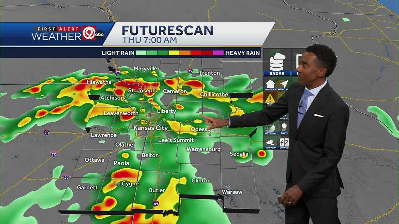
Good evening, everyone. I want to give you a quick but thorough update on what’s happening with the weather here in Kansas City—because it's been an intense night. If you’ve been listening to the thunder or caught those flashes of lightning out your window, you’re definitely not alone. We’ve been dealing with strong thunderstorms across the metro, and the impact has been significant enough that a flash flood warning is currently in effect until 4:45 a.m.
Now, while we aren’t seeing any severe thunderstorm or tornado warnings as of now, don’t let your guard down. The bigger issue tonight is rain—heavy, persistent, and falling over the same areas again and again. Parts of Johnson County, including Lenexa, Overland Park, and areas along I-435, have been experiencing the brunt of it. Nearly 200 lightning strikes have been recorded in a short span, and these storms are slow movers. That’s what makes flooding a real threat. With 1 to 3 inches of rain already on the ground and another half inch to 2 inches expected before sunrise, the potential for flash flooding is very real.
Also Read:- Phil Mickelson Stuns with Miracle Bunker Shot at The Open 2025
- From Outlaw to Open: Ryan Peake's Gritty Journey to Royal Portrush
This storm system is sticking around through the early morning hours, especially between midnight and 7 a.m., which could make your Thursday morning commute pretty difficult. Water pooling on roads, reduced visibility, and slick highways are all things to watch out for. It’s a classic "impact morning" in weather terms, so give yourself extra time if you need to be out early.
The silver lining? Things start improving by late morning. Rain tapers off, and by the afternoon we’ll actually see some clearing. Temperatures tomorrow will be much cooler—around 79 degrees for the high—which is a welcome break from the heat we've been dealing with. No need for the umbrella after lunchtime tomorrow.
But don't get too comfortable. Starting Friday, things heat back up again. We'll be in the upper 80s to low 90s, and by this weekend, we could be hitting mid-90s. And next week? It's looking like a serious heat wave. We could see highs creeping toward 100 degrees by Wednesday or Thursday. That means high humidity, high heat index levels, and another round of weather to be cautious about.
So to wrap this up—tonight, it’s all about staying dry and safe. If you're seeing standing water, don’t try to drive through it. Keep an eye on alerts from local weather services. And then prepare for some cooler air on Thursday, before we dive right back into the heat.
Stay safe out there, Kansas City.
Read More:


0 Comments