

Tropical Storm Chantal Nears Carolina Coast with Heavy Rain and Rip Current Threats
As we move through the first week of July, all eyes are on the Atlantic coastline as Tropical Storm Chantal continues its slow but determined approach toward the southeastern United States. This is the third named storm of the Atlantic hurricane season, and unlike the first two—Andrea and Barry, which came and went with little fanfare—Chantal is making her presence known.
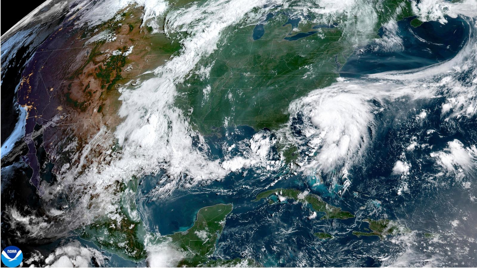
Right now, Chantal is positioned about 95 miles southeast of Charleston, South Carolina, carrying maximum sustained winds of 45 miles per hour. The storm is tracking slowly north at just 7 mph, keeping coastal residents on edge. The National Hurricane Center has issued tropical storm warnings that now stretch up to Surf City, North Carolina, meaning conditions are expected to deteriorate across the coastal Carolinas beginning Saturday evening.
Also Read:- Mike Stevens Joins Canada's Finest as Order of Canada Appointee
- Cubs Crush Cardinals with Historic Home Run Barrage on July 4th
This storm is already pushing scattered showers and thunderstorms inland from its outer bands. Rough surf and dangerous rip currents are impacting beaches along both South Carolina and North Carolina. It’s a lopsided system, with most of the active weather sitting well to the east of the exposed storm center, which could limit how much stronger it gets before landfall. Still, a slight increase in intensity is possible before Chantal reaches the coast—most likely during the early morning hours on Sunday along the South Carolina shoreline.
Flash flooding is a real concern here. Forecasts are calling for 2 to 4 inches of rain across the region, with isolated totals reaching up to 6 inches. That’s enough to overwhelm drainage systems and cause rapid water rise in low-lying areas. Add to that a minor storm surge of 1 to 3 feet in some coastal zones, and we’re looking at multiple threats converging over a relatively short period.
Beachgoers from northeastern Florida all the way to the Mid-Atlantic should be extremely cautious. Even if you're hundreds of miles away from the storm’s center, the surf and rip currents Chantal generates could be life-threatening.
After landfall, the system is expected to speed up and rapidly weaken, eventually downgrading to a tropical depression. But the story doesn’t end there. Remnant tropical moisture will linger across parts of the Mid-Atlantic through Monday, potentially interacting with an approaching cold front early next week to fuel additional thunderstorms in areas like Maryland and Delaware.
So, whether you’re on the coast or further inland, this storm is one to watch. If you're in an affected area, keep up with local alerts, follow evacuation recommendations if they come, and don’t underestimate the power of even a modest tropical storm like Chantal. Storms like this are reminders of how quickly summer skies can turn turbulent.
Read More:


0 Comments