

UK Thunderstorm Alert as Heatwave Fades and Cooler Weather Sets In
So, we’ve officially waved goodbye to the scorching heatwave that had the UK sweating through the end of June and the start of July. Just yesterday, we experienced the hottest day of the year so far — a staggering 34.7°C recorded in London’s St James’s Park. But now, in a dramatic shift, cooler and fresher weather is settling in across the country, and it's bringing along some turbulent conditions.
Let me paint the picture for you: after a blistering few days, the atmosphere has flipped. Today, temperatures are taking a noticeable dip, ranging from around 16°C in the north to 26°C in the south. Nights are becoming more comfortable too, with that stifling, sticky heat now giving way to a much fresher feel. It's a welcome change for many of us, no doubt.
Also Read:- Andrés Giménez Delivers Crushing Blow to Yankees with Clutch Home Run
- Diego Luna Shines as USA Reaches 2025 Gold Cup Final
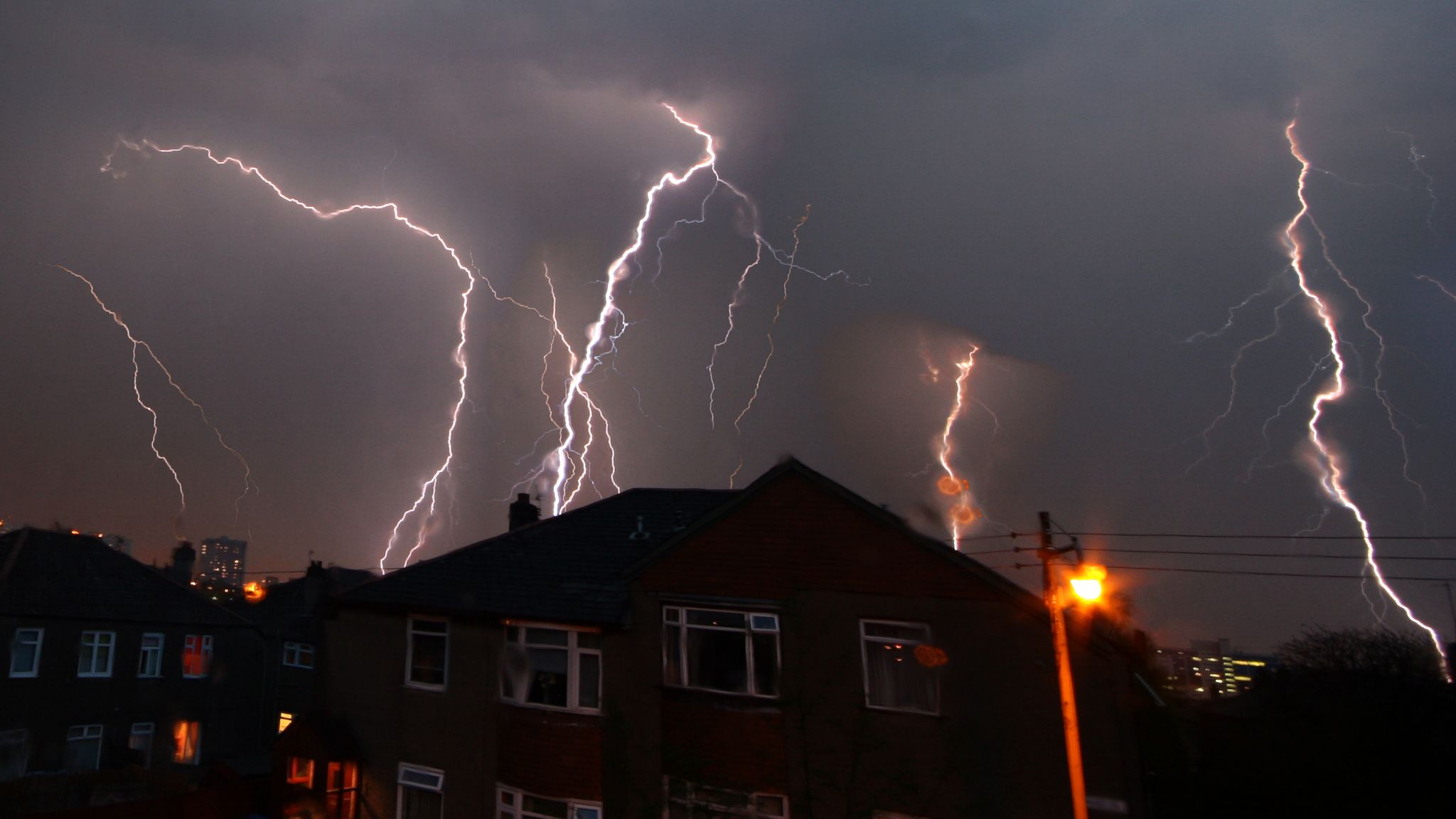
However, as this cooler air moves in, the Met Office has issued a yellow weather warning for thunderstorms. These storms are expected to develop over northeast England and southeast Scotland, affecting areas from north of Edinburgh to south of Durham. This warning runs from 11am to 6pm today, and it’s not to be taken lightly.
Forecasters are warning of intense, short-lived downpours — we’re talking 15 to 20mm of rain falling in under an hour in some spots. That’s enough to cause localized flooding, and with the lightning strikes also in the mix, there's a risk of damage to buildings and power lines. Gusts of wind could also reach up to 40mph, so if you're out and about, do take care. There might even be short-term power losses in certain areas, and travel disruptions on both road and rail are a real possibility.
And it’s not just about today — we’re entering an unsettled phase. While there’s no return to heatwave conditions in the near future, there may be brief warm spells here and there. Friday, for instance, could touch highs of 27°C or 28°C in the far southeast. But for the most part, expect cooler, cloudier skies and scattered showers, especially in Scotland and Northern Ireland.
Meanwhile, the recent dry spell still has parts of the UK on edge. Yorkshire and Northwest England are already in drought conditions, with river flows across two-thirds of England now below normal. Even though some rain is forecast, it may not be enough to significantly ease these dry conditions — especially with fire risks still elevated in certain areas due to the dry ground and tinderbox vegetation.
In summary, while we may be relieved to escape the extreme heat, it’s a turbulent transition. So keep an umbrella handy, stay weather-aware, and take any thunderstorm warnings seriously. The British summer is far from predictable, and this week is a perfect reminder of just how quickly things can change.
Read More:


0 Comments