

Thunderstorms and Heavy Rain Forecast for Southern England and Wales
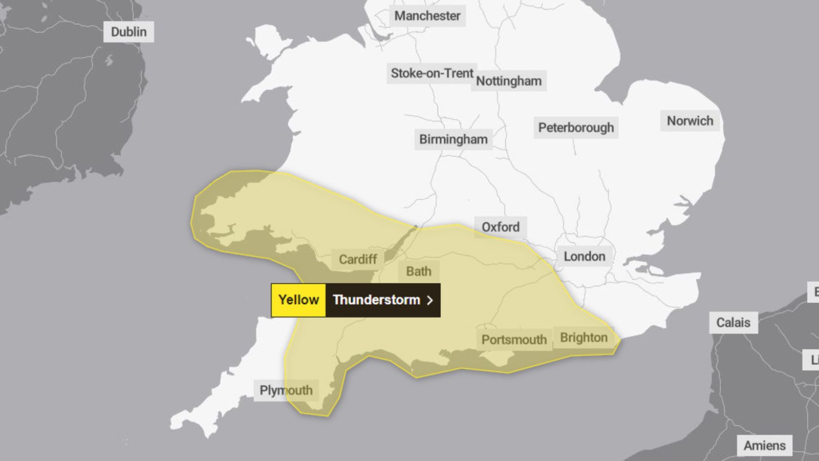
As the weather takes a turn, residents in southern England and Wales should brace for thunderstorms and heavy rain today. The Met Office has issued a yellow thunderstorm warning, which will be in effect from 4 PM to midnight. The areas most affected include much of south Wales, southwest England, and parts of southern England. This warning is significant as it highlights the potential for travel disruption, with forecasts indicating that driving conditions may deteriorate due to spray, standing water, or even hail. Train services are also likely to face delays.
Frank Saunders, a chief meteorologist at the Met Office, has outlined the severity of the situation, explaining that some locations could experience 20 to 30 millimeters of rain within just two to three hours. In some cases, a small number of areas could receive up to 40 millimeters of rain during this brief period. The coastal districts, particularly those facing south, are expected to be the hardest hit by thunderstorms. With the possibility of hail and strong gusts accompanying these heavy showers, the risk to both personal safety and property is heightened. Flooding of homes and businesses is also a real concern, particularly in coastal regions where lightning strikes, hail, and gusty winds could cause significant damage.
Also Read:- A Dazzling Display of Northern Lights Graces Airdrie's Skies
- Miami International Airport Evacuation: What You Need to Know
Looking ahead, more heavy showers and thunderstorms are anticipated across central and southern parts of the UK tomorrow and into Wednesday. In addition, a prolonged period of heavy rain is expected in parts of southeast Scotland and northeast England as we move through the week. Although the risk of flooding may diminish, additional weather warnings are likely until midweek as rain continues to fall on already saturated ground.
Interestingly, there’s also the possibility of ex-Hurricane Kirk influencing our weather patterns. The Met Office has indicated a growing confidence that this storm will pass to the south of the UK, bringing heavy rains and strong winds to northern France instead. While changes in its track are still possible, the likelihood of significant impacts on the UK has decreased.
As we transition through the week, temperatures are expected to drop significantly, particularly in the northern regions, with all areas likely experiencing below-average temperatures by Thursday. Night frosts are anticipated for some areas, and higher mountainous regions in Scotland could even see snowfall.
It’s crucial for residents to stay informed and prepared as these weather systems unfold, particularly given the potential for disruptive conditions in the coming days. For the latest updates, you can check the Met Office's forecasts on their website or through their mobile app. As always, keeping an eye on the weather is essential, especially during such unsettled times. Stay safe and weather aware!
Read More:


0 Comments