

A Journey Through Weather Radar Evolution at the National Weather Service in Louisville, KY
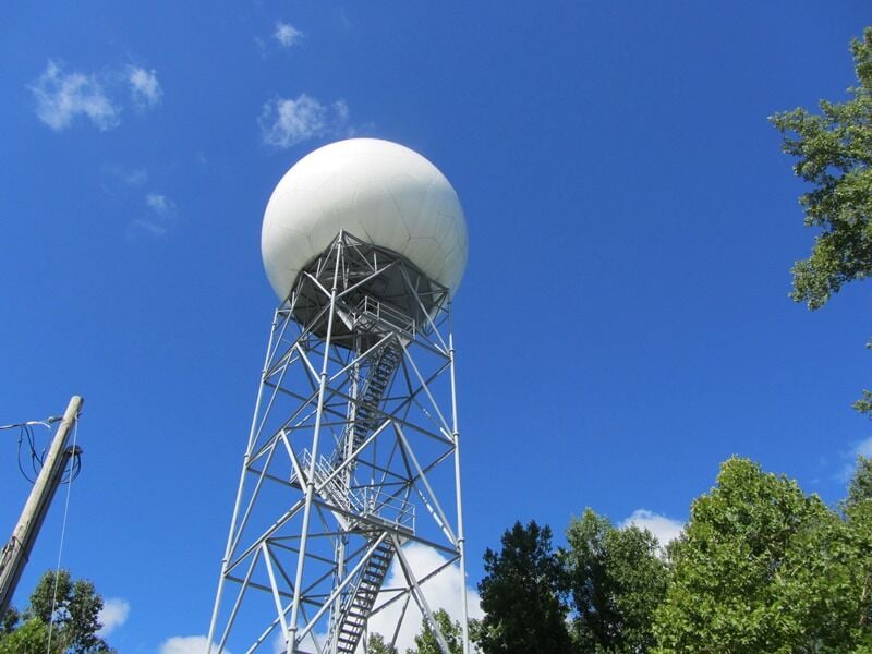
The weather radar system plays a vital role in tracking and forecasting weather patterns, helping to protect lives and property. In Louisville, KY, the National Weather Service (NWS) has been utilizing weather radar technology for decades, with significant improvements made over the years. As of November 29, 2024, the WSR-88D Doppler radar system, which has been in service for 30 years, continues to be an essential tool for monitoring weather across southern Indiana and central Kentucky.
The journey began in the 1980s when weather radar technology was becoming more advanced. The WSR-88D Doppler radar, installed at Fort Knox in 1994, was a major milestone. It provided forecasters with the ability to detect not just precipitation, but also wind patterns, helping to improve the accuracy of weather predictions. This was especially important in detecting severe weather events such as tornadoes, thunderstorms, and winter storms. Over the years, the radar system has undergone numerous upgrades and improvements, allowing for clearer and more precise data.
Also Read:- India's Preparation Ahead of Pink-Ball Test: PM-XI Match Highlights
- Fortnite Chapter 6 Kicks Off with New Map, Features, and Epic Concert Event!
The Doppler radar is different from older radar systems because it can detect the motion of precipitation particles. This allows meteorologists to track the movement of storms and provide warnings in real time. It has been crucial in tracking severe weather systems, giving residents in the affected areas more time to prepare and take safety measures.
Throughout its history, the NWS office in Louisville has used various radar technologies. Each new system has brought better resolution, faster processing, and more detailed weather information, enabling more accurate predictions and more effective warnings. The radar’s ability to track not only the amount of precipitation but also the intensity of wind is a game changer for forecasting severe weather like tornadoes. As a result, these radar systems have significantly improved public safety and awareness.
Today, the WSR-88D Doppler radar continues to be a cornerstone of weather forecasting in Louisville, helping meteorologists track everything from daily showers to major storm systems. The radar network is constantly being improved to keep up with the evolving nature of weather patterns and technology. These advancements ensure that meteorologists can provide the most accurate and timely weather forecasts possible, which in turn helps the public stay prepared and safe in the face of unpredictable weather.
Looking back at 30 years of progress, the evolution of weather radar technology at the National Weather Service office in Louisville highlights the importance of innovation in meteorology. With the continuing development of radar systems, the future looks even brighter for weather forecasting, offering even more detailed insights into the atmosphere’s ever-changing patterns.
Read More:


0 Comments