

Severe Weather Alert: Tornado Warnings Across Central Alabama
Folks, we’ve got a serious situation unfolding across central Alabama right now. This is a First Alert Weather Day , and we need to stay on high alert as multiple tornado warnings are in effect this evening. Powerful supercell thunderstorms, which have already caused damage in Mississippi, are racing into Alabama at speeds of 50 mph. This is a dangerous and fast-moving system that we need to take seriously.
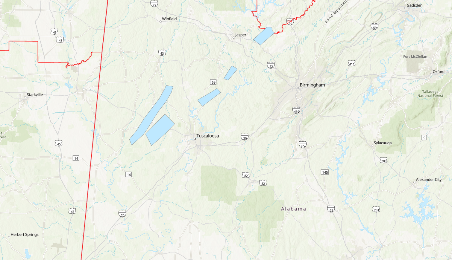
A Particularly Dangerous Situation (PDS) Tornado Watch has been issued for 27 counties in Alabama , including Jefferson, Tuscaloosa, Shelby, Montgomery, and more. This means conditions are prime for violent, long-track tornadoes—these aren’t just quick spin-ups; these storms could stay on the ground for miles, causing major destruction.
Also Read:- Bennett Shines with Two Power-Play Goals as Panthers Edge Maple Leafs
- William Shatner Celebrates 43 Years ofT.J. Hooker—A Classic TV Cop Drama
Right now, storms are hammering West Alabama and moving quickly towards the I-65 corridor by 5 p.m. . Expect heavy rain, gusty winds exceeding 70 mph , golf ball-sized hail , and a very high likelihood of tornadoes. A rare high risk (level 5 out of 5) for severe weather has been issued—this is not something we see often in Alabama. It’s crucial that everyone has a way to receive weather alerts and knows exactly where to go if a warning is issued for their area.
Here’s what you need to do right now :
- Stay informed – Have multiple ways to receive weather alerts, whether it’s a NOAA weather radio, the First Alert Weather App , or live updates from WBRC.
- Have a safety plan – Identify the safest place in your home —a basement or an interior room on the lowest floor away from windows.
- Wear shoes and helmets – If a tornado strikes, these simple steps could protect you from injury.
- Spread the word – Check on your friends, family, and neighbors to ensure they are also prepared.
Looking ahead, conditions will improve by Sunday , with dry and seasonal weather returning for St. Patrick’s Day . However, a cold front could bring another round of showers towards the end of next week, though at this time, severe weather isn’t expected.
For the latest updates, stay with WBRC and James Spann Live as we track these storms throughout the night. This is a dangerous situation, folks—stay weather aware, and don’t take any chances. If a tornado warning is issued, take cover immediately. We will continue to provide live updates to keep you and your family safe.
Read More:


0 Comments