

Tornado Watch Issued for North Texas – Stay Alert and Prepared!
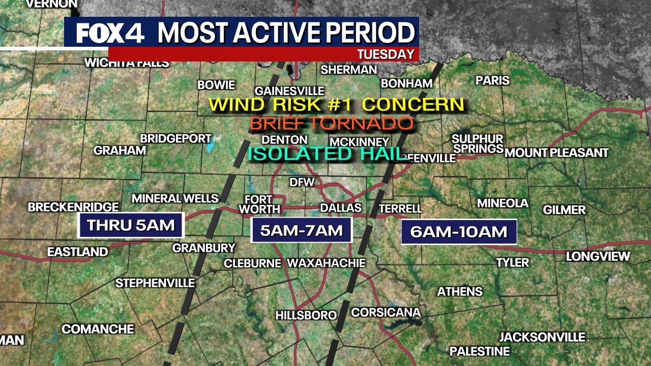
Hey everyone, if you’re in North Texas, listen up because we’ve got some serious weather moving in. A Tornado Watch has been issued for the region until 11 a.m. , and things are already getting intense. We’re talking about severe thunderstorms, hurricane-force winds, and the potential for quick-developing tornadoes. If you’re waking up to weather sirens or power outages, this is why.
Right now, several Severe Thunderstorm Warnings are in effect across multiple counties, including Dallas, Collin, Kaufman, Ellis, and Navarro. Some of these storms are producing winds over 70 to 80 mph , which is strong enough to cause damage —knocking down trees, power lines, and even damaging homes. In fact, just this morning, DFW Airport recorded a wind gust of 74 mph, and Dallas Love Field reported an even stronger gust of 78 mph. That’s hurricane-force wind strength.
Also Read:- Cooper Connolly's Surprise Inclusion in Australia's Champions Trophy Semifinal Squad
- Canadiens Edge Sabres in OT Thriller for Fifth Straight Win
If you’re driving this morning, be extremely careful. Major highways like I-35E, I-20, I-30, and I-45 are all within the severe weather zone. Strong crosswinds can make driving dangerous, especially for high-profile vehicles like trucks and vans. And if you see flooded roads, turn around, don’t drown.
Right now, power outages are already a major issue. Over 300,000 customers are without power across the region. If you experience an outage, you can report it by texting OUT to 66267 , calling your utility provider, or using their mobile app.
So, what can you expect for the rest of the day? This storm system is moving fast, and by later this morning, we should see conditions improving. However, the wind is going to stick around. A Wind Advisory remains in effect until 9 p.m. , with gusts up to 50 mph. That means unsecured outdoor objects could become projectiles, and driving may still be hazardous.
Later this afternoon, we’re expecting some sunshine , but don’t let that fool you—it’ll still be very windy with gusts up to 45 mph . And by tomorrow morning, temperatures are going to drop significantly into the 40s, with even a light freeze possible in some areas .
The bottom line? Stay weather aware. Have your phone alerts on, follow your local news, and make sure you have a plan in case conditions worsen. If you’re under a tornado warning, seek shelter immediately in a sturdy structure, preferably in an interior room away from windows.
We’ll keep you updated as more information comes in. Stay safe out there, North Texas!
Read More:


0 Comments