

DC Braces for Severe Thunderstorms and Flooding Amid Heat and Humidity
Hey everyone, just a quick but important weather update for the D.C. area—something you’ll want to be prepared for if you're heading outside today. We’re currently under both a Severe Thunderstorm Watch and a Flood Watch , and the weather is already building up to deliver some intense conditions this afternoon and evening.
As of now, temperatures are climbing to nearly 90 degrees, but with the intense humidity blanketing the region, it feels even hotter—well into the low to mid-90s. That thick, muggy summer atmosphere is exactly what fuels unstable conditions, and unfortunately, that’s exactly what we’re dealing with today.
Also Read:- John Obi Mikel Stirs Debate Over Rico Lewis Red Card at Club World Cup
- Sophie Thibault Bids Farewell to a Legendary Career With Grace and Quiet Strength
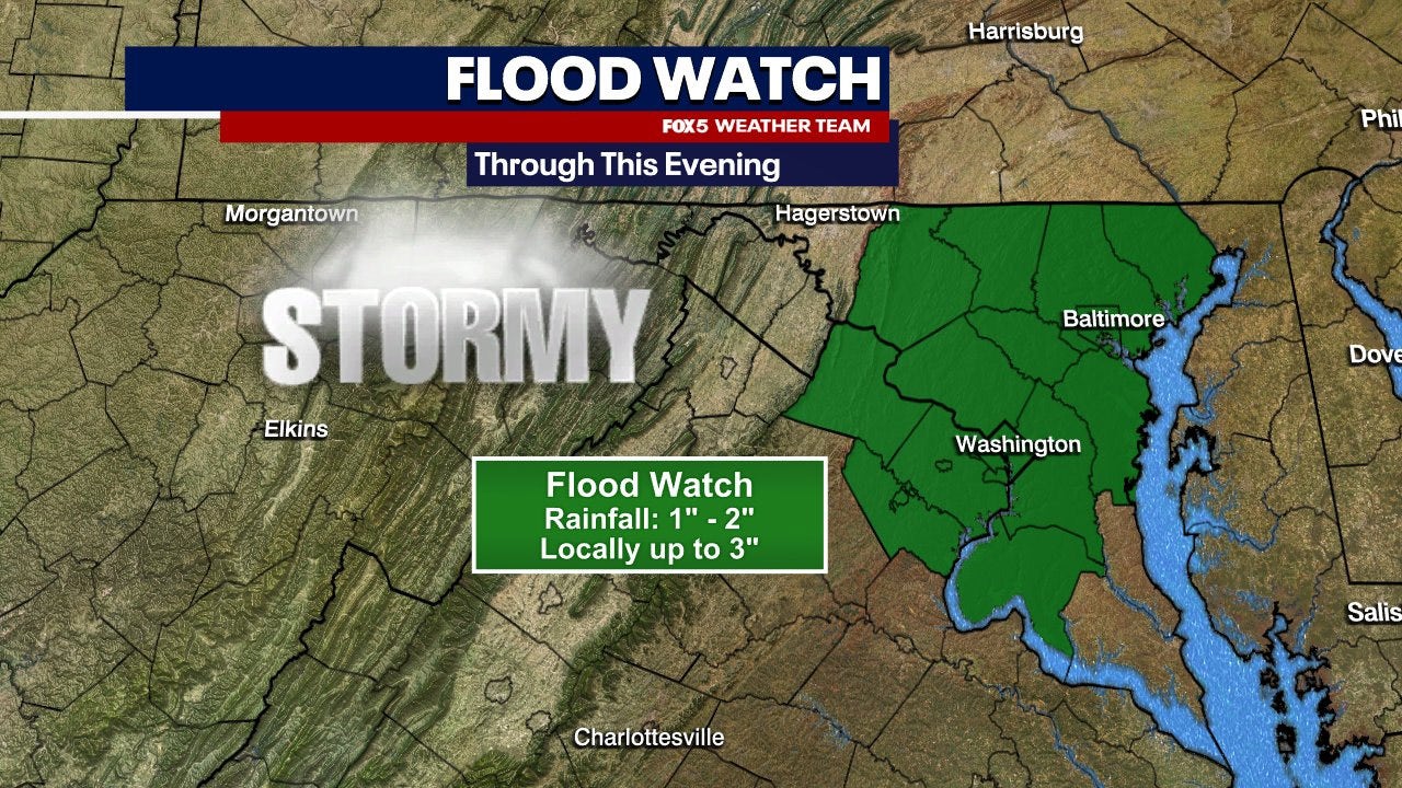
So, here’s what’s happening: scattered pop-up thunderstorms are expected to begin forming as early as noon and continue through the early evening. Some of these storms have the potential to become severe—bringing along damaging wind gusts , torrential downpours , and yes, the risk of flash flooding . The Severe Thunderstorm Watch is in effect until 7 p.m., and the Flood Watch runs until 8 p.m., particularly affecting areas along the I-95 corridor, including D.C., Maryland, and northern Virginia.
If you started the morning with overcast skies or even some light mist or fog, that’s already begun to clear, giving way to peaks of sunshine—and that sunshine is helping to trigger the storms. What makes today’s weather especially tricky is that these storms could pop up earlier than the usual late-afternoon timeline we often see in summer. That means your lunchtime plans or early commutes home could be directly impacted.
The National Weather Service has placed the region under a marginal risk (Level 1 out of 5) for severe weather today. However, tomorrow’s looking even more active. A cold front is moving in on Thursday, which could bring stronger and more widespread thunderstorms, with conditions again pushing highs into the upper 80s and low 90s.
And while we officially kick off summer this Friday with the solstice, it won’t be bringing much relief. Expect more heat, high humidity, and a stretch of hot, storm-prone days heading into the weekend. Saturday, in particular, could see the beginning of a serious heat wave.
So here’s the deal— stay weather-aware . Have a way to receive alerts, especially if you're out and about. Secure loose items around your home or yard, and avoid low-lying or flood-prone areas during heavy rain. And of course, don’t forget to stay hydrated and practice heat safety, especially if you have to be outside for long periods.
Stay safe out there, D.C. We’ll keep you posted as the storms roll through.
Read More:


0 Comments