

Thunderstorms and Heat Warnings as Oxford Braces for a Weather Rollercoaster
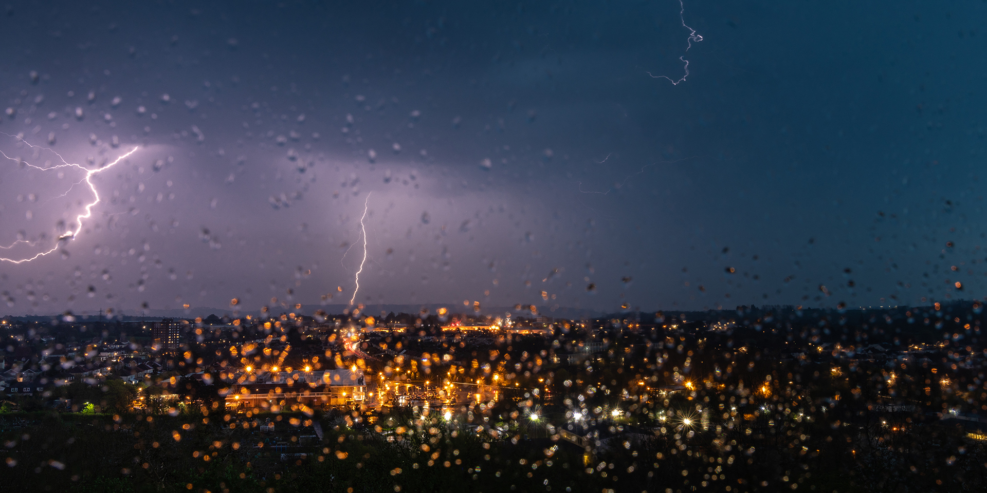
Hey everyone, let’s talk about what’s happening with the weather right now — and trust me, it’s not your typical British drizzle. If you’re in Oxford or anywhere in southern England, you’ll want to pay close attention. We’re heading into a stretch of dramatic weather, and the Met Office has just issued several yellow warnings for thunderstorms. That’s right — after a warm and sunny spell, things are taking a sharp turn.
So here’s what’s going on. The UK is transitioning into a warmer, but more unsettled period. We've had some pleasant sunshine recently, but now heavy rain and thunderstorms are moving in, starting with parts of southwest England and Wales overnight, and spreading to Northern Ireland by Thursday morning. Oxford and surrounding areas aren’t in the clear either — Friday into Saturday, a warning covers southeastern England, including us, and it's bringing the potential for flash flooding, lightning, hail, and strong winds.
Also Read:- Fatal Day in Fleetwood: Gunfire Claims Life Near Surrey Community Centre
- Spokane Community Stunned as Human Rights Commissioner Named in Wrongful Death Lawsuit
Chief Meteorologist Neil Armstrong — yes, that's really his name — said that we could see up to 40mm of rain falling in just three hours. That’s a lot. And with thunderstorms developing fast and moving northwards, there could be some serious localised impacts. Surface water flooding is a real concern, especially in places like Oxford where the drainage systems can get overwhelmed quickly.
Now here’s the kicker: it’s going to stay hot through all this. Temperatures are expected to hit 28 or even 30 degrees in some parts of the southeast, with Oxford likely feeling the heat too. In fact, the UK Health Security Agency has issued yellow Heat Health Alerts from Thursday night through Sunday morning. That means vulnerable people — the elderly, young children, and those with medical conditions — could be at risk. So if you're checking in on grandparents or neighbours, now’s the time.
And as if that’s not enough, more rain is on the cards for Friday morning, with even heavier and more humid air being pulled in from the south. Deputy Chief Meteorologist Tony Wisson pointed out that while it’s still a bit uncertain where the worst of it will land, some areas could see over 50mm of rain, with strong gusts and frequent lightning strikes making it dangerous for both travel and outdoor plans.
Friday’s likely to be the hottest day of this warm spell, and while that might sound great, it’s coming at a cost. So stay weather-aware. Download the Met Office app, check updates regularly, and if you're planning anything outdoors, have a Plan B ready. Whether it’s commuting, festivals, or just walking the dog — keep one eye on the sky and the other on your weather alerts.
In short, it’s a mix of sun, heat, and sudden storms — classic British summer chaos. Stay safe out there.
Read More:


0 Comments