

UK Hit by Thunderstorm Alert as Events Cancelled and Flood Risks Rise
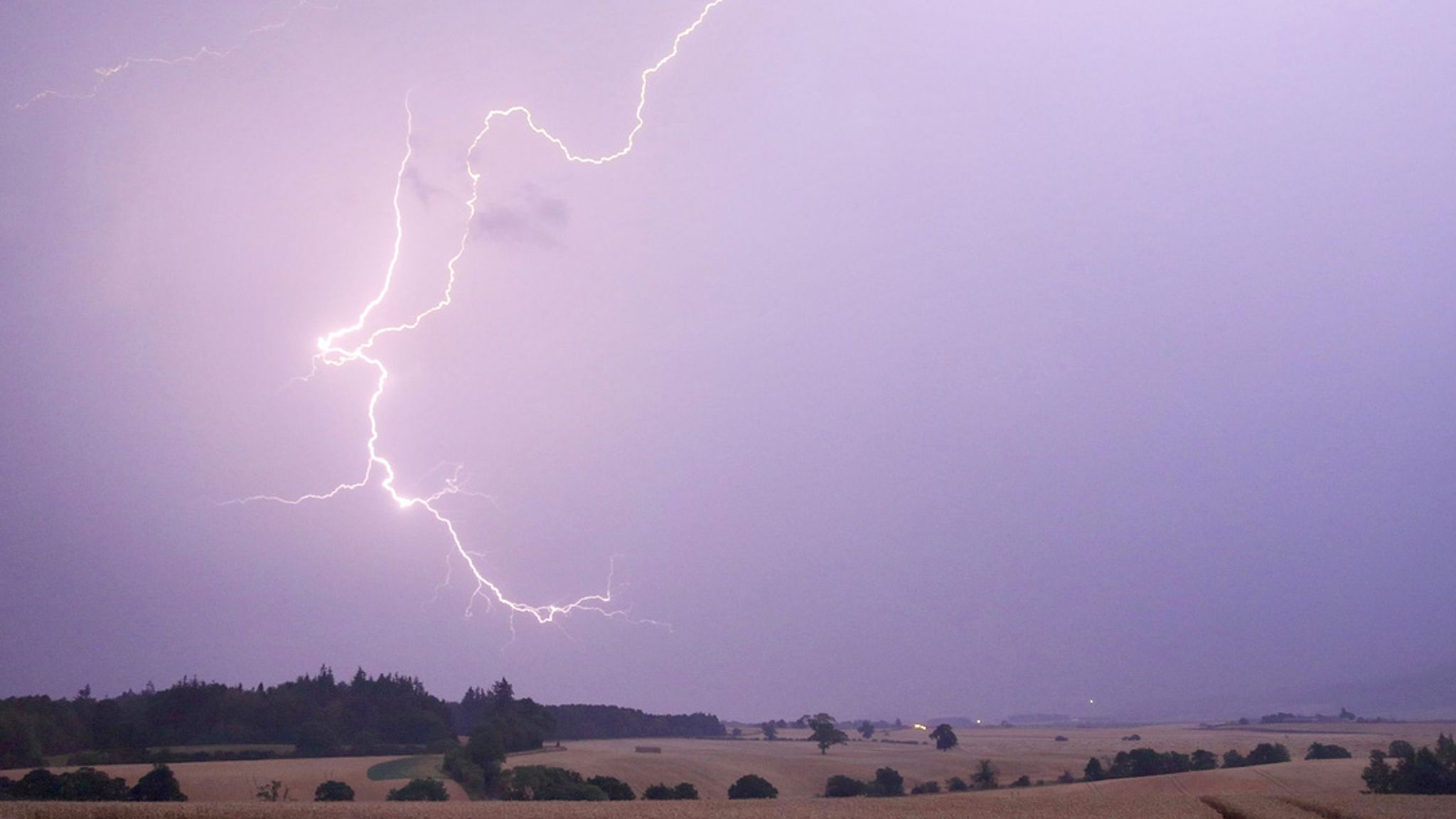
So, let’s talk about what’s really going on with the UK weather right now—it’s one of those weekends where you seriously reconsider all your plans. The Met Office has issued a yellow weather warning for thunderstorms that’s affecting a large chunk of England and Wales, including major areas like London, the South East, parts of the Midlands, and even deep into South Wales. This warning runs from 9am to 6pm, and it’s not just about a bit of rain—it’s about intense downpours , frequent lightning , hail , and strong winds .
Also Read:- Greta Thunberg's Gaza Aid Mission Blocked by Israeli Forces
- Severe Storms Slam North Texas with Damaging Winds and Flash Floods
We’re not just talking about a passing shower here. Some places could see 30mm to 40mm of rain in just a few hours , which can easily trigger flash flooding in vulnerable areas. Imagine that kind of water hitting already saturated ground—it’s a mess waiting to happen. And this is serious enough that events are getting cancelled . For example, the Sussex Classic 2025 , a major surf ski race that also serves as an assessment for Team GB, had to be pulled. That’s a huge blow, especially since it had a record number of entries.
Similarly, the Kent Wind Festival at Betteshanger Park had to scrap its opening day. They’re hoping to resume activities like kite flying by Sunday, but Saturday’s events are off the table—for safety reasons, of course.
Now, travel’s another big concern. If you’re heading out by train or car, delays and disruptions are pretty likely. Lightning and high winds can mess with infrastructure, and the Met Office has even said that power cuts are a possibility in some areas. So if you’re out and about, make sure your phone’s charged and you’ve got some kind of plan B.
Interestingly, this wild weather comes right after the UK was declared to have had its warmest and driest spring in decades . It feels like we just skipped seasons entirely—from a dry, sunny spring straight into a storm-packed summer. And looking ahead, it’s not all doom and gloom, but we’re not out of the woods either. Conditions are expected to gradually ease off from the west by late afternoon, and the forecast for next week includes more rain, especially in the north.
Still, with climate patterns shifting, these rapid swings in weather seem to be our new normal. So whether it’s a thunderstorm warning, a flood risk, or an unexpected heatwave, it’s always a good idea to stay updated with the Met Office alerts. And maybe keep that umbrella—and a backup charger—handy.
Read More:


0 Comments