

FireSat Satellite Network Will Scan Earth Every 20 Minutes to Detect Wildfires
Let me tell you about something groundbreaking that's happening right now—something that could literally save lives and landscapes all over the world. Imagine a system in space, orbiting high above us, that watches over the Earth not just once a day, but every 20 minutes. That’s exactly what’s coming with the launch of a new satellite constellation called FireSat by a company named Muon Space.
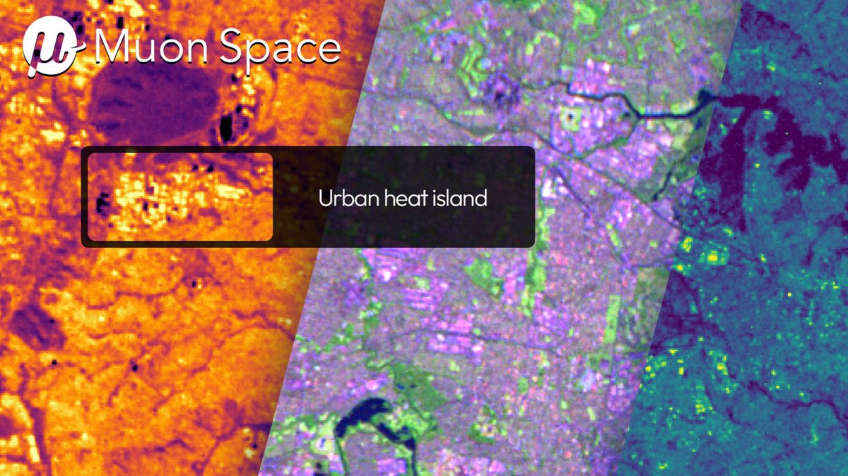
Three months ago, Muon Space launched the first prototype of this system, called FireSat Protoflight. And the early results? Absolutely stunning. Using incredibly advanced infrared technology, the satellite has already captured detailed thermal images from space. We’re talking about pinpointing heat signatures across vast terrains—everything from urban runways in Sydney, Australia to the glowing lava of Hawaii’s Kīlauea volcano, even gas flares in the Libyan desert. This isn’t your average satellite imagery. FireSat can detect heat variations so precise that it can spot small wildfires as tiny as 15 feet wide.
But here’s the real game-changer: this system isn’t just about taking pretty pictures from orbit. It’s built to detect wildfires in real-time—before they rage out of control. The infrared sensors on board can differentiate between natural heat sources and those unique to fire. And because it uses six infrared bands ranging from visible to long-wave infrared, it can even detect cooler fires that might go unnoticed by other systems.
Also Read:- Medford Faces Overnight Power Outage: What You Need to Know Tonight
- Celebrating Canada Day 2025: What to Expect and How to Join In
This isn’t a one-off mission. Muon Space plans to launch over 50 of these satellites by 2030, creating a global grid capable of scanning the entire Earth every 20 minutes. That means areas most vulnerable to wildfires—think California, Australia, the Amazon—will get even more frequent checks.
Behind this massive effort is a collaboration between Muon Space and the nonprofit Earth Fire Alliance. They’ve received support from partners like Google Research and the Moore Foundation to make sure this project delivers high-resolution, actionable data to first responders, governments, and communities who need it most.
Let that sink in: satellites, working around the clock, will soon be monitoring our forests, grasslands, and populated areas for the first signs of disaster. It’s a huge leap forward from current detection methods that rely on spotty ground reports or flyovers. Instead, FireSat provides a constant stream of updates—essentially giving Earth its own wildfire early-warning system.
To sum it up, this is one of the most exciting advances in remote sensing and environmental protection in years. With wildfire seasons growing longer and more intense around the world, this satellite network couldn’t be coming at a better time. The data it gathers has the potential to drastically improve how quickly we respond to fires—and how much we can prevent them from turning catastrophic.
We're witnessing the beginning of a new era in Earth observation, where technology from orbit serves as our global guardian.
Read More:


0 Comments