

Spain on Storm Alert: Torrential Rains and Intense Heat Collide Today
As I speak to you now, the weather across Spain is undergoing a dramatic and potentially dangerous shift. We’re heading into a weekend that’s anything but calm, with intense storms already developing or just hours away from impacting several regions of the country. If you were expecting a typical July weekend of sunshine and blue skies, it’s time to rethink your plans.
A significant weather system—known as a trough—is sweeping across the Iberian Peninsula, and it's triggering explosive thunderstorm activity in at least seven autonomous communities. This system pulls cold air from the upper levels of the atmosphere and mixes it with the extreme surface heat and moist sea air from the Mediterranean and Cantabrian coasts. That combination is the perfect recipe for chaos in the skies: heavy downpours, large hail, and very strong wind gusts, even exceeding 80 km/h in some areas.
Also Read:- Stranded in Paradise: The F-35B Fighter Jet Making Waves in Kerala
- Tension Rises as Norris and Hamilton Set the Pace Ahead of British GP Qualifying
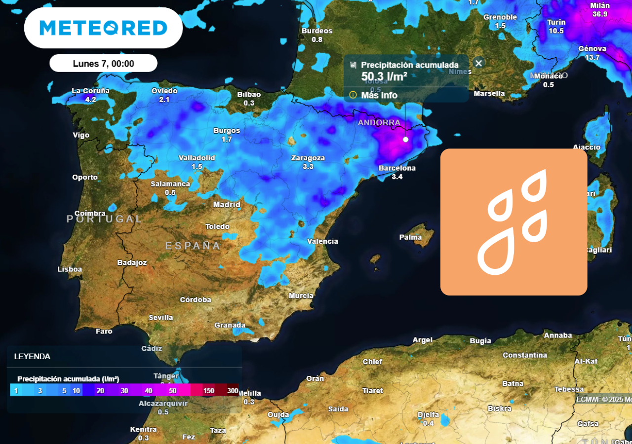
The Spanish national weather agency, AEMET, has issued orange alerts in areas such as the Catalan Pyrenees, northern Aragón, parts of Navarra, La Rioja, and Castilla y León. In some cases, more than 50 liters per square meter of rain could fall in under three hours. That kind of rainfall can lead to flash floods, especially in mountain valleys and urban centers with poor drainage. There’s even the potential for hailstones as big as 5 centimeters and localized tornado-like activity.
This isn't just an afternoon thunderstorm you can wait out in a café. These are supercells and organized convective systems—essentially, severe storm systems that can last for hours, cross provinces, and leave damage in their wake. And while the northeast faces storms, the south of Spain continues to bake. In places like Córdoba, Badajoz, and parts of Andalucía and Castilla-La Mancha, temperatures are reaching or exceeding 40ºC again, despite the recent heatwave supposedly ending.
Meanwhile, the Canary Islands are dealing with their own challenges. Though not affected by the same storm systems, they're experiencing extreme heat and dusty conditions from lingering calima. Temperatures in southern Gran Canaria are soaring past 36°C, and the trade winds are blowing hard in exposed areas.
And it doesn’t end tonight. The storm activity is expected to last well into the evening and might only start to fade during the early morning hours. On Sunday, storms are still expected to hit Catalonia, Teruel, and Castellón with force. High-resolution weather models continue to show large swaths of red and purple over the maps of northeastern Spain, indicating more intense rainfall and strong convective potential.
So if you're out and about today or planning to travel, keep a close eye on local weather alerts. Don’t underestimate the power of these summer storms—they’re not just a visual spectacle, they’re potentially life-threatening if you’re caught unprepared. Stay safe, stay informed, and let’s hope the storm passes without serious consequences.
Read More:


0 Comments