

Torrential Floods Slam New Jersey as Emergency Declared Across Northeast
What we witnessed across New Jersey and the broader Northeast over the past 24 hours has been nothing short of overwhelming. Relentless, torrential downpours have turned busy highways into rivers and neighborhoods into flood zones. The I-95 corridor, one of the busiest transport routes in the country, has been absolutely hammered by heavy rain, with conditions so severe that multiple major cities—including Baltimore, Philadelphia, and Washington, D.C.—were placed under a Level 3 out of 4 flash flood risk.
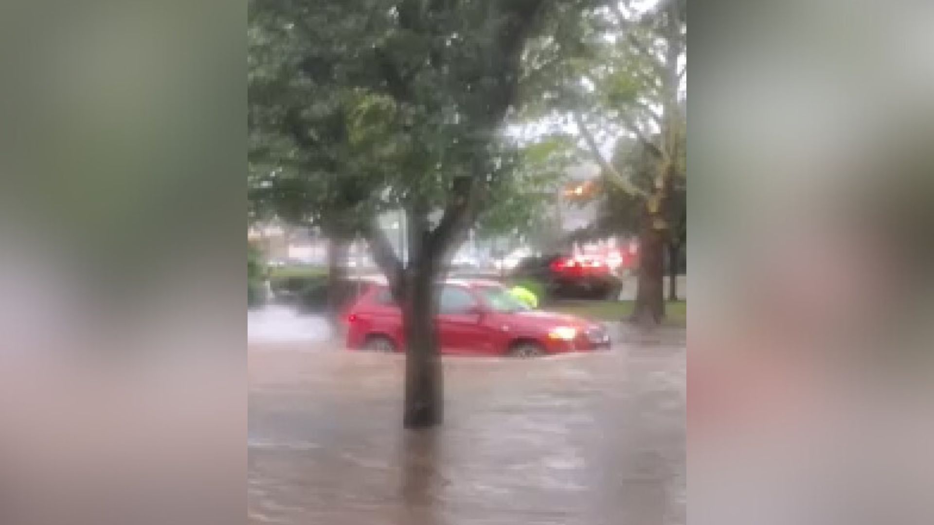
In New Jersey specifically, the situation escalated rapidly. Governor Phil Murphy declared a State of Emergency Monday evening as floodwaters rose quickly and unexpectedly across numerous towns and counties. Streets were submerged, homes isolated, and emergency responders stretched thin. In Somerset County, officials issued a rare shelter-in-place order, pleading with residents to stay indoors and off the roads due to the hazardous conditions. As of late Monday night, all travel was strongly discouraged. Rescue operations were already underway in North Plainfield, where the mayor confirmed over 30 homes required urgent assistance and dozens of people were evacuated to temporary shelters.
Also Read:- Inside “Alligator Alcatraz”: The Hidden Reality of America’s Most Controversial Detention Site
- "A Final 'I Love You': The Painful Goodbye in the Idaho College Murders"
Public transportation systems were crippled. NJ Transit trains and New York City subways were hit hard, with service delays and suspensions cascading across the region. Airports across the Northeast faced major disruptions, with Ground Stops in effect, stranding thousands of travelers.
One of the most staggering statistics came from New York City, where between 7 and 8 PM Monday night, a record-breaking 2.07 inches of rain fell in just one hour—making it the city’s second-wettest hour on record, behind only the remnants of Hurricane Ida. Videos from Times Square, White Plains, and Bridgewater showed cars stranded and water rushing through the streets like a current. Even I-78 was swallowed by floodwaters, creating dangerous conditions for drivers and emergency responders alike.
The atmospheric setup is to blame: a slow-moving cold front brought record-level moisture into the region. Storms repeatedly hit the same areas, leading to “training” rain bands that dumped 3 to 5 inches of rain within hours. With already saturated ground from previous rainfall, flash flooding became inevitable. The FOX Forecast Center warned that rain could fall at rates of over 3 inches per hour in some locations—far too much for the storm drains to handle.
As Tuesday unfolds, rain will become more scattered, but the threat hasn’t fully passed. The skies will remain overcast, and a new wave of storms is already expected later in the week. The entire eastern seaboard is seemingly locked into this wet pattern, with only brief periods of relief.
To everyone in the affected areas—please stay alert. Do not drive through flooded roads, and heed all local warnings. What we’re experiencing isn’t just bad weather. This is a climate event that’s testing infrastructure, emergency systems, and community resilience.
Read More:


0 Comments