

UK Braces for Isolated Thunderstorms and Flash Floods Amid Hot, Dry Weather
Hey everyone, have you noticed the weather's been feeling kind of strange lately? One moment it’s hot and sunny, and then suddenly we’re hit with thunder, lightning, and torrential rain. That’s exactly what’s happening across the UK right now, and it’s got the Met Office on high alert. So let’s talk about what’s actually going on.
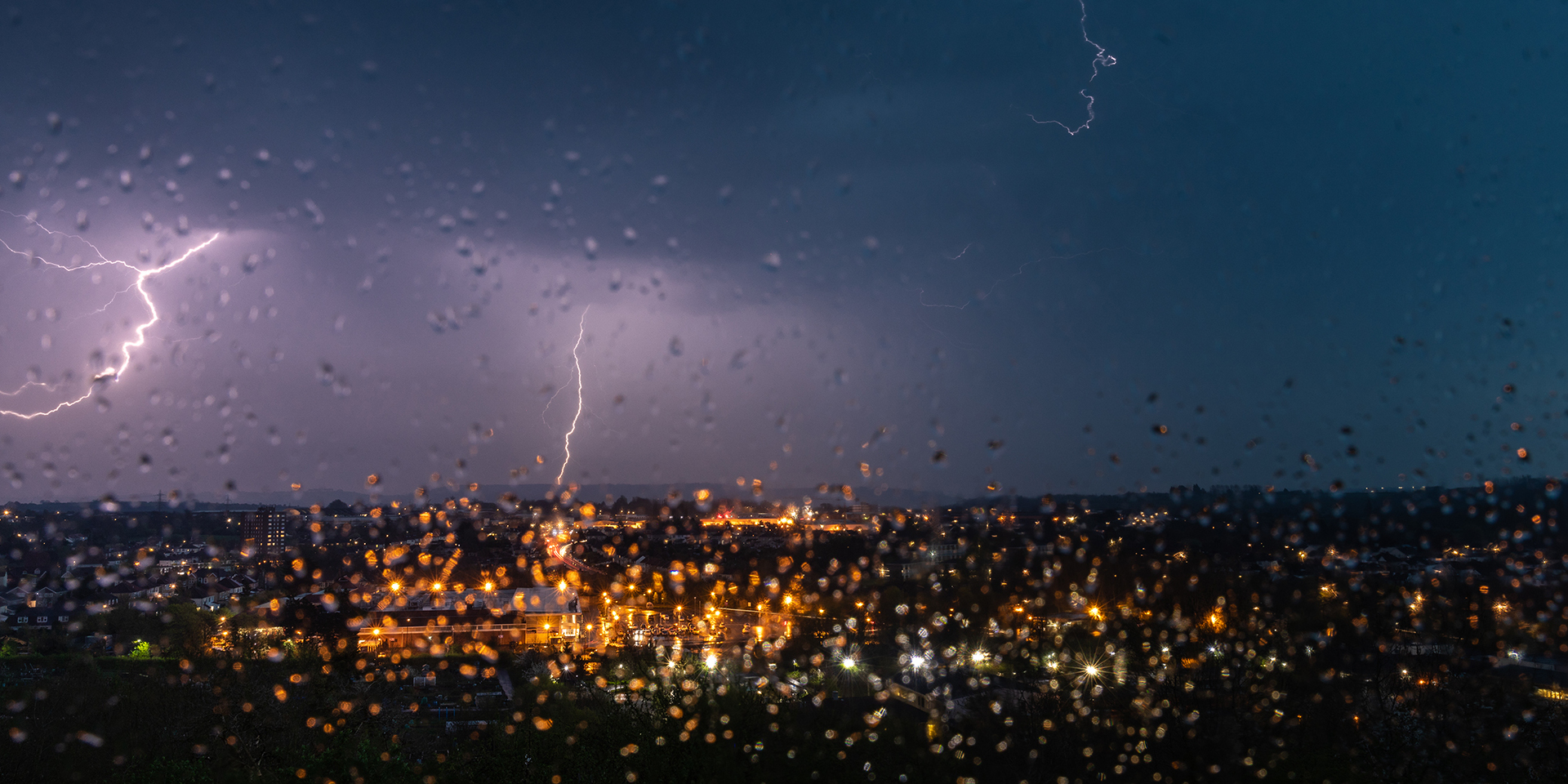
A yellow weather warning has been issued for a large part of the country, especially for England and parts of Wales and Scotland. Starting Friday night and continuing into Saturday, we’re expecting some intense thunderstorms. And I’m not just talking about a bit of rain—some areas could see up to 60 to 90mm of rainfall within just a few hours. That’s more than a month’s worth of rain falling all at once.
What makes this even more concerning is the condition of the ground right now. After a series of heatwaves, the soil has become extremely dry and hard. When heavy rain hits soil like that, it doesn’t soak in—it runs right off. That rapid runoff can quickly overwhelm drainage systems and lead to flash flooding in both urban and rural areas.
Also Read:- Dubois Ready for Redemption in Epic Usyk Rematch at Wembley
- Toyota Issues Major Recall of Nearly 70,000 Vehicles Over Instrument Cluster Fault
The weather system responsible for this chaos is forming over France, where warm, moist air near the surface is clashing with cooler air higher up in the atmosphere. That instability causes air to rise fast and form thunderstorms, which then drift north into the UK.
On Friday night, southern and central parts of England—especially the southeast and the Midlands—will likely be hit first. Then, by Saturday, the storm activity is expected to move further north, impacting northern England and Scotland. Some regions might even see persistent rainfall into Sunday, particularly across northern Scotland, increasing the risk of localised flooding even further.
And while the storms will bring heavy downpours, they also come with other risks—frequent lightning, strong gusty winds, and even large hail in some places. These conditions could cause power outages, travel disruption, and localised damage to buildings and infrastructure.
Despite all this rain, it’s important to understand that this won’t do much to ease the current drought. Water levels in many reservoirs are still critically low. Places like Yorkshire are under hosepipe bans because reservoir storage has dropped significantly. And even though this heavy rain sounds like a good thing, most of it will either run off or be used up by thirsty plants and trees. It’s not going to be absorbed deeply enough to restore groundwater levels.
So, in short: hot and muggy conditions continue, but with the added risk of severe thunderstorms, flash floods, and localised disruption. If you’ve got weekend plans—especially if you're heading to a festival, travelling, or planning to be outdoors—keep an eye on the forecast. Stay weather-aware, be prepared for sudden downpours, and try to avoid driving through floodwater.
Let’s all stay safe out there, and hopefully the weather settles down soon.
Read More:


0 Comments