

Powerful Storms Threaten Philly with Floods, Hail, and High Winds
Hey everyone, just wanted to give you a heads-up on some serious weather rolling into the Philadelphia region. We’ve got a pretty intense storm system making its way through, and it’s packing quite a punch — we’re talking heavy rain, hail, powerful wind gusts, and even the possibility of flash flooding. This is not just your typical late-May storm.
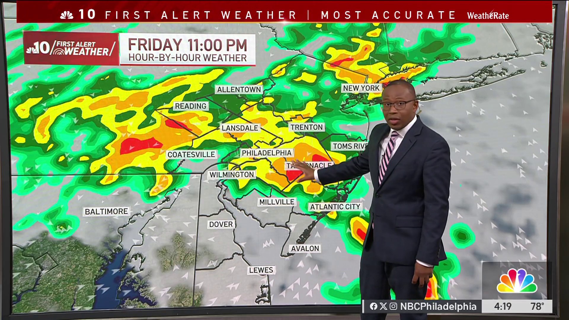
Right now, a tornado watch is in effect across the entire Philly area until just before midnight tonight. The National Weather Service is warning that the atmosphere is highly energized — that’s meteorologist-speak for “things could get rough fast.” Heavy rain is expected to start falling after 8 p.m., and it's not going to be just a sprinkle. We could see as much as 3 inches of rainfall overnight, which is enough to trigger flash floods in some spots, especially low-lying areas and places with poor drainage.
Also Read:- Widespread Flight Disruptions Hit YVR After Runway Closure
- Tornado Warning Rocks Cecil County Amid Severe Weather Surge
There’s also a coastal flood advisory out for the tidal Delaware River. Onshore winds are pushing water back upriver, and with all the runoff from the storm, minor flooding is possible in and around Philly. The flood watch is scheduled to remain in effect until 8 a.m. Saturday. Combine that with westward winds gusting up to 40 mph early Saturday morning, and we’re in for a bumpy ride.
Even though it’s been wet lately — we’ve had over 5 inches of rain this month, well above average — drought advisories are still hanging on, believe it or not. The area’s been recovering slowly from last fall’s extreme dryness. Some counties in Pennsylvania, like Chester and Montgomery, are still flagged as abnormally dry or even in moderate drought. Meanwhile, much of New Jersey is under a drought warning.
But this storm could help change that. Some experts are saying this might be the wettest month we’ve had since March 2024. Still, the rain has mostly come in small doses, spread out over time. That’s helped reduce the risk of widespread flooding — until now. This evening's fast, heavy rainfall could overwhelm storm drains and streams.
There’s also an agricultural angle to all this. Local farms like Stella Farms in Berlin have already called an early end to their strawberry season because of the excess rain and cloudy skies. And if this pattern keeps up, it could continue to impact local crops.
So, if you’re out and about tonight, stay safe. Keep an eye on alerts, avoid flooded roads, and if you’re in a flood-prone area, take precautions now. The skies might be moody, but being informed can make a huge difference.
Read More:


0 Comments