

Hurricane Erick Slams Mexico with Devastating Force as a Stark Reminder of the Season Ahead
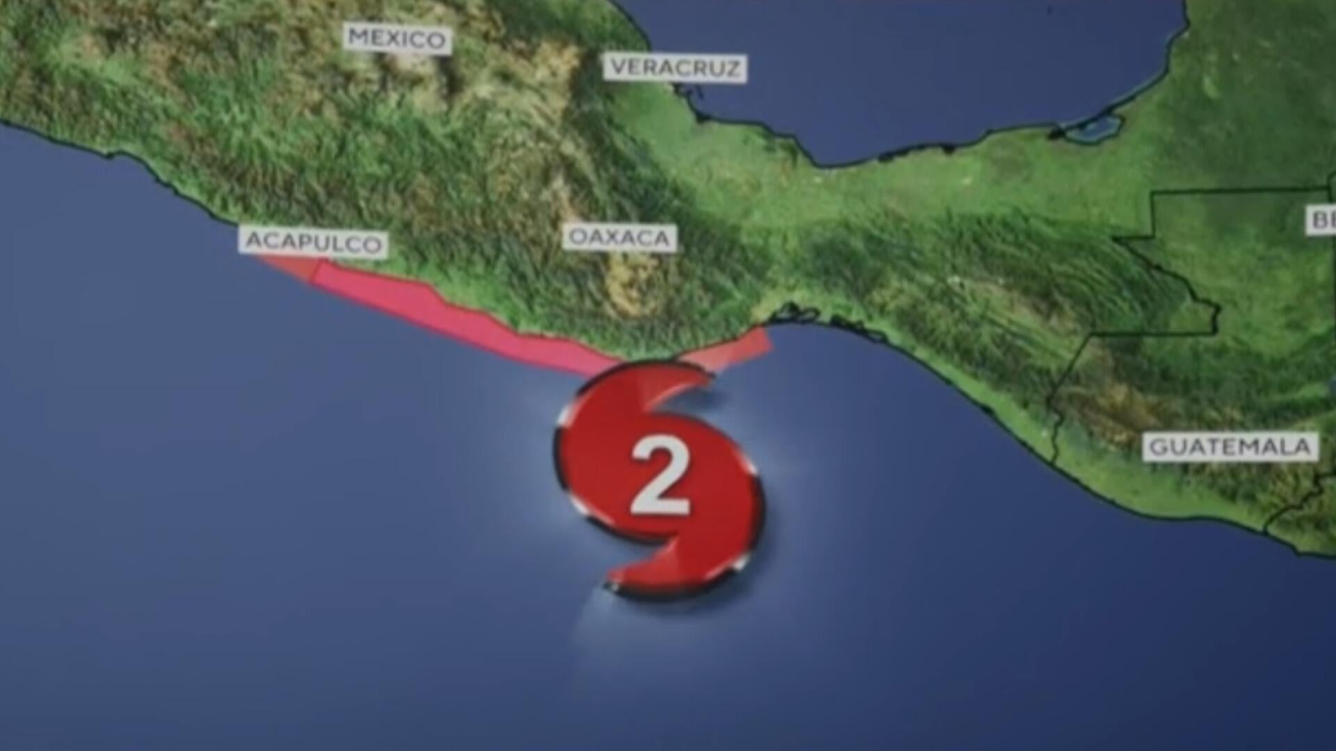
As of this morning, Hurricane Erick made a dramatic landfall on the western coast of Oaxaca, Mexico, packing a serious punch as a Category 3 storm. Just hours before hitting land, Erick had intensified rapidly into a Category 4 storm with winds reaching up to 140 mph — a terrifying speed that quickly downgraded but still delivered potentially catastrophic impacts. This marks the fifth named storm in the Eastern Pacific hurricane season so far, and notably the first major hurricane of the year in that region.
When Erick struck just east of Punta Maldonado, sustained winds were clocked at nearly 125 mph. For context, that's enough to uproot trees, tear off roofs, and cause prolonged power outages. While the winds are dangerous on their own, the bigger threat might be what's less visible at first glance: the water. Forecasters are warning of "life-threatening" flooding and mudslides — and these aren’t hypothetical dangers. Storms like this one, especially over mountainous regions like Oaxaca and Guerrero, can dump anywhere from 8 to 16 inches of rain. When that happens fast, rivers swell, hillsides collapse, and entire communities can be cut off or destroyed in the blink of an eye.
Also Read:- Luke Hodge Laughs Off Emergency Room Trip After Social Basketball Injury
- Youth Hockey Coach Ryan Wood’s Assault Case Delayed Amid Growing Scrutiny
Storm surge is another silent killer in these situations. Near the point of landfall and to the west, coastal flooding driven by a sudden rise in sea level is expected, bringing with it massive, destructive waves that pound the shoreline. Places like Acapulco, still recovering from the devastation of Hurricane Otis in 2023, are once again bracing for impact. That storm reached Category 5 status and claimed dozens of lives. The scars are still fresh.
While the hurricane has begun to weaken now that it's moving inland, the risk doesn’t vanish with the wind. The National Hurricane Center has emphasized that inland flooding, often overshadowed by wind ratings, is historically the deadliest aspect of hurricanes. And for those living in steep terrain, like much of southern Mexico, mudslides pose a real and imminent threat.
Looking at the bigger picture, this storm is part of what’s projected to be an active and intense hurricane season. The Eastern Pacific’s season runs from May 15 to November 30, while the Atlantic season started June 1. And with climate patterns intensifying storms more frequently, communities along coastlines and in vulnerable terrain zones must remain alert and prepared.
This isn’t just about one storm. Erick is a glaring signal that hurricane season is in full swing — and it’s not letting up. Preparedness isn't optional anymore; it's survival. Whether it’s through trusted media outlets or verified emergency updates on social platforms, staying informed is absolutely vital. Nature has already sent its warning shot. Now, it’s time to listen.
Read More:


0 Comments