

Storms Slam Northland with Flooding Rain and Severe Weather
Hey everyone, just wanted to give you a quick but important update about the wild weather we’ve had over the past couple of days. If you live in northern Minnesota or northwest Wisconsin, then you already know — this wasn’t just a passing shower. We’re talking about a powerful system that brought flooding rain, damaging winds, hail, and even some travel disruptions across the region.
It all started early Tuesday, July 15, when strong thunderstorms fired up near the International border. By morning, those storms had shifted into the Arrowhead region of Minnesota. After a little mid-day break, the skies opened back up again in the afternoon — and the storms just kept coming. Warnings, watches, and advisories were issued throughout the day, and the Storm Track Weather team was on it nonstop, tracking everything from heavy downpours to wind gusts and even hail.
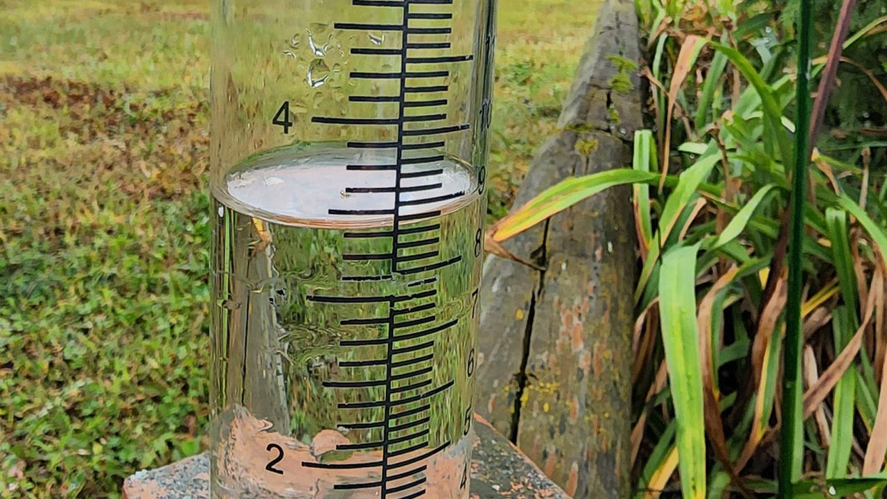
Now, let’s talk about the rainfall. These numbers are intense. The highest total came in from Gordon, Wisconsin — over five inches of rain. Nearby Solon Springs wasn’t far behind with more than five inches as well. Aurora, Knife River, and Washburn also saw over four inches. That’s just in one day — and it explains the flash flood warnings that were issued, especially across northwest Wisconsin.
Also Read:- Mix Tape: A Nostalgic Love Story with a Soundtrack That Hits Home
- Canada Reopens Parents and Grandparents Sponsorship: What You Need to Know in 2025
Even areas like Duluth and Two Harbors picked up between two to three inches. It was widespread, relentless rain. And it didn’t stop Tuesday — it kept going into Wednesday morning. The National Weather Service reported dozens of locations with rainfall totals over two inches. That's a lot of water in a very short time.
It wasn’t just rain either. Winds hit 52 miles per hour in Ashland, which is no joke. That’s enough to bring down branches or even cause some power outages. And yes, there was hail — close to an inch in places like Wrenshall and Solon Springs.
So what does this mean moving forward? Wednesday has stayed soggy with off-and-on showers, cooler temps, and just that gray, unsettled vibe. But the good news? Relief is on the way. By Thursday, we're expecting sunshine, lower humidity, and a calm return to summer as it should be.
But for now, if you're heading out or commuting, just take it slow — a lot of that rain may still be sitting on roads and low-lying areas. And check in with local alerts — some flood warnings are still in effect.
This week has been a real reminder of how fast weather can change around here. Stay safe, stay dry, and keep your weather apps close.
Read More:


0 Comments